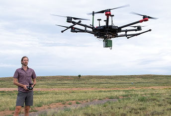
Remote sensing Assistant Professor Austin Madson assembles and tests a M600 drone
prior to a lidar mapping mission east of Laramie.
Contact Us
Institutional Communications
Bureau of Mines Building, Room 137
Laramie, WY 82071
Phone: (307) 766-2929
Email: cbaldwin@uwyo.edu


Geospatial science—the science of place—reaches across colleges and into our daily lives.
By Micaela Myers
With most of us attached to a smartphone, we’re using geospatial data wherever we go—whether we know it or not—from the ads that pop up based on our location to mapping our way to a destination. The University of Wyoming offered classes in this area for many years, but last academic year, a formal program launched through the Wyoming Geographic Information Science Center (WyGISC) to offer certificates in geospatial information science and technology (GIST), a master’s degree and a new bachelor’s degree to launch fall 2022.
“It’s become so infused into everything we do in our modern lives that there’s a huge market out there for students who have good foundational training,” says WyGISC Director Jeff Hamerlinck.
The program draws students from various professions and backgrounds. It offers undergraduate certificates in geographic information systems (GIS) and remote sensing, the new bachelor’s degree that will require a minor from any discipline, and at the graduate level a master’s degree in geospatial information science and technology as well as graduate certificates in GIS, remote sensing and unmanned aerial systems (UAS, or drones).
Naturally Interdisciplinary
“Geospatial science is the science of place,” Hamerlinck says. “What that means is geospatial science applies to everything that can be associated with a location. It’s becoming increasingly important across disciplines.”
For example, maps are important to zoology, ecology, botany, wildlife conservation, biology, geography and anthropology, as well as other disciplines that may seem less obvious such as economics, social sciences and business. An economics major could earn a certificate in GIS and be a stronger candidate for a job that uses place-based analytics.
“I think the new GIST program is the latest interdisciplinary aspect of what we do at WyGISC,” Hamerlinck says. “It’s our 25th anniversary this year. The thread that’s wrapped though everything we’ve done is place, and that’s inherently interdisciplinary, because pretty much everything happens somewhere.”
The center leads the way with drone activities on campus—from working with folks in engineering who are building drones to using drones to collect data across disciplines. The center recently hired a new expert in this area and hopes to expand offerings.
“As UW looks to become more interdisciplinary, we can give faculty members opportunities to work and partner with the center,” Hamerlinck says.
Workforce Development
The graduate programs are offered online, allowing students to maintain their jobs wherever they live.
“We have students from both coasts and in between,” Hamerlinck says. “They can earn these credentials without having to come to Laramie.”
Already, the program attracted students from the Fremont County Weed and Pest Control District, Wyoming State Parks, the Wyoming Army National Guard, game and fish agencies in other states, public health agencies, the federal Bureau of Land Management and Bureau of Reclamation.
“Local, state and federal agencies are big employers of students with geospatial, remote sensing and drone skills,” Hamerlinck says.
This includes local government such as county assessors and public works and city planning departments and also extends to private companies. “A data scientist may work behind the scenes at Google to help develop the algorithm that creates the database that helps you navigate via Google maps,” Hamerlinck says.
Environmental consulting firms are contacting the GIST program about internship opportunities because they need people with this background.
The GIST program also partners with community colleges, offering students a next step in their education.
Student Perspectives
Sarah Weidler of Cheyenne, Wyo., initially became interested in GIS as an undergraduate because it was the course of study that best allowed her to integrate skills she learned as a geospatial and satellite imagery analyst in the U.S. Navy. Now she’s beginning her master’s degree in the GIST program.
“The faculty who makes up the GIST program are passionate, knowledgeable and supportive,” she says. “I believe that the GIST program at UW offers me unique experiences in drone technology, which is a rapidly growing field.”
Through the GIST program, she’s learned geospatial visualization, programming, specialized GIS software, map design, best practices
for data organization and management, drone technology basics, remote sensing analysis techniques and database management. Weidler says that the program also helped her enhance her research, creativity and problem-solving skills.
“These skills will help me to be well-equipped for a future career in GIS,”
she says. “As a lifelong Wyoming resident, I want to bring new GIS skills and technology to Wyoming’s workforce.
I believe that earning a graduate degree in GIST from UW will help me reach this goal.”
She could see herself working as a GIS or remote sensing specialist or cartographer in a governmental or environmental capacity or as a professor.
“I would definitely recommend this program to future students,” Weidler says. “GIST is a growing field that will offer good opportunities for future employment.”
Undergraduate senior Gabriella Dodgson, also of Cheyenne, is pursuing certificates in GIS and remote sensing with a major in environmental systems science. She previously studied GIS at San Diego State University before transferring. She has found the GIS program at UW to be a welcoming new home.
“I loved taking the summer UAV (drone) classes and having the opportunity to do GIS and remote sensing projects that are applicable to the real world,” Dodgson says.
As a student, she works as a GIS tech for WyGISC in Shannon Albeke’s lab, working with Agisoft Metashape software to 3D model organ pipe and saguaro cactus volumes.
After graduation this December, she hopes to work as a GIS developer, possibly earning a master’s degree first.
This past spring in her in Spatial Data Visualization class, Dodgson learned to take different data sets and to create incredible maps and visualizations.
Dodgson says, “I think everyone should at least take an introductory GIS course to understand how important spatial data is in our everyday lives.”
Inspiring the Next Generation
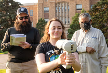
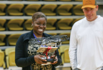
Wyoming Excellence in Higher Education Endowed Chair of Science Education Tim Slater is teaming up with the UW Trustees Education Initiative (TEI) and the Wyoming Department of Education to bring drone competitions and educator training to Wyoming communities. These hands-on events get K-12 and college students excited about future careers they could have using drones.
“The ability to fly, repair and program drones is one of the most valuable new technical skillsets of the decade. Our events introduce skills that enable students to pursue careers using drones in agriculture, construction, filmmaking, and coding,” Slater says.
The team hosts professional training for local educators alongside the competitions to provide the skills and resources needed to maintain student interest. So far, they have exposed about 60 Wyoming educators and nearly 100 students to skills that will lead them to become lifelong drone enthusiasts.
“We are excited about the energy surrounding this drone project and the multitude of Wyoming industries it can serve. It adds to the growing array of student experiences, educator training and community and workforce development partnerships supported by TEI,” says UW TEI E-4 Director Curtis Biggs.
This effort will help develop a pool of Wyoming students who are highly qualified and passionate about working with drones. These skills will set them up for success as they enter UW, community colleges and vocational schools.
Contact Us
Institutional Communications
Bureau of Mines Building, Room 137
Laramie, WY 82071
Phone: (307) 766-2929
Email: cbaldwin@uwyo.edu