|
I'm a faculty member in the Botany Department and the Wyoming Geographic Information Science Center (WyGISC). I'm an adjunct faculty in the Department of Ecosystem Science & Management (ESM) and the Science & Math Teaching Center (SMTC).
Home
Teaching
Research
Publications
Outreach
Personnel
Research
My research program is supported through funding from a) AmericaView, b) Upper Midwest Aerospace Consortium (University of North Dakota), c) National Fish and Wildlife Foundation, d) National Science Foundation, e) Wyoming Water Program, f) Wyoming Cooperative Extension, and g) Wyoming Center for Environmental Hydrology and Geophysics.
Current projects:
- WyomingView (2002 - Present) - program funded by AmericaView and USGS since 2002 to promote remote sensing science and applications in Wyoming through education, outreach, and applied research. To learn more more about WyomingView, internship opportunities, k-12 outreach, and other accomplishments, click here ....
- Wyoming Interns to Teacher Scholars (WITS) Porgram (2014 - Present) - funded by the National Science Foundation to: 1) engage in early recruitment activities at high schools and two-year colleges; (2)provide summer internships in STEM; (3) offer tutoring and mentoring by STEM faculty; and (4) provide professional development opportunities
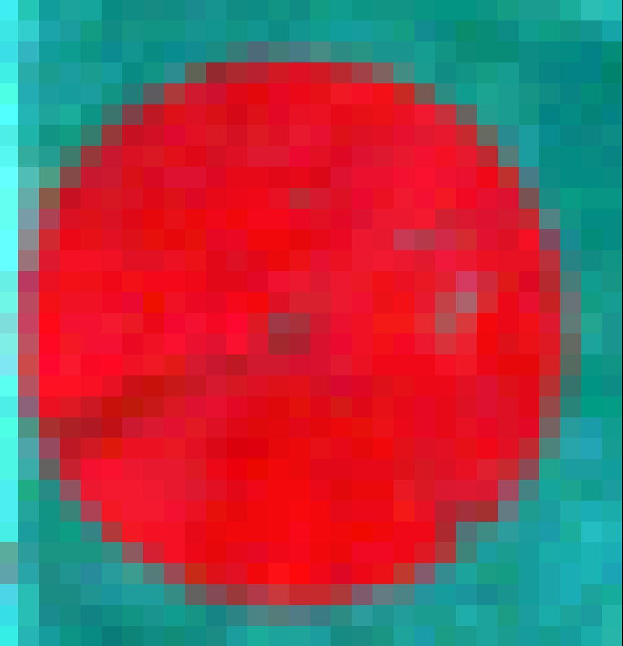
Crop growth in a small field, SE Wyo.
Bright red shades = high growth areas
Dark red shades = poor growth areas
(Landsat image - bands 432)
Completed projects:
- Promoting Inquiry Based Learning of the state and changes of waterbodies using satellite images in elementary school grades two through four (2016 - 2017). This project is funded by the Wyoming Center for Environmental Hydrology & Geophysics.
- Generating land cover maps in 3-year time steps depicting progression of bark beetle infestation for Snowy range and Laramie range watersheds (2015 - 2017). This project is funded by the Wyoming Center for Environmental Hydrology & Geophysics.
- Crop growth monitoring in small Wyoming farms (2010 - 2015) - assess crop growth using multi-temporal Landsat and similar moderate resolution imagery. This project is funded by University of Wyoming Extension.
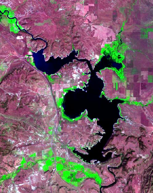
- Monitoring Wyoming's water resources (2013 - 2014) - reconstructing past changes in reservoirs and lakes using historial satellite images. This project was funded by the UW Office of Water Program.
- Remote Sensing Education and Research for Sustainable Natural Resource Management in Wyoming (2004-2012). This research was supported by UMAC - Upper Midwest Aerospace Consortium, (funded by the University of North Dakota & NASA) to develop products and services using satellite images and other geospatial technology.
- Mapping land cover associated with Italian locust habitats in Pavlodar, Kazakhstan (2008-2009). This project was supported by the Duetsche Gesellschaft fur Technische Zusammenarbeit (GTZ) GmbH.
- Mapping land cover associated with Moroccan locust habitats in southeast Qarshi Region, Uzbekistan (2008-2009). This project was supported by the Duetsche Gesellschaft fur Technische Zusammenarbeit (GTZ) GmbH.
- Mapping small water bodies in Powder River Basin using Landsat and ASTER data (2005-2008). This project was funded by UW Department of Renewable Resources (presently ESM) and the US Department of Energy.
- Characterizing shrubland vegetation (2005-2009) - improving the predictability of shrubland vegetation characteristics using moderate spatial resolution satellite images. This research was funded by the National Fish and Wildlife Foundation (NFWF).
- Mapping Asian Migratory locust habitats south of Aral Sea, Uzbeksitan (2004-2005). This project was supported by Duetsche Gesellschaft fur Technische Zusammenarbeit (GTZ) GmbH.
- Mapping Asian Migratory locust habitats in River Ili Delta, Uzbekistan (2003-2004). This project was funded by UW Department of Renewable Resources (presently ESM) and UMAC.
URL: http://www.uwyo.edu/sivan
More updates in ResearchGate |
LinkedIn
Updated by Ramesh Sivanpillai on Sep 25, 2019
|