
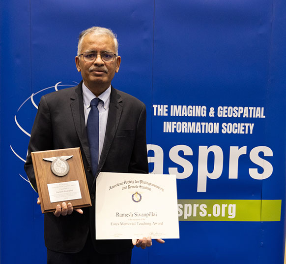
Ramesh Sivanpillai, an instructional professor in the Wyoming Geographic Information Science Center and UW School of Computing, recently received the Estes Memorial Teaching Award from the American Society for Photogrammetry and Remote Sensing. He was honored during the recent GeoWeek 2026 Conference in Denver. (Caroline Hubert Photo)
A University of Wyoming faculty member was recently bestowed a top teaching honor
from the American Society for Photogrammetry and Remote Sensing (ASPRS).
Ramesh Sivanpillai, an instructional professor in the Wyoming Geographic Information
Science Center and UW School of Computing, recently received the Estes Memorial Teaching
Award from the organization.
The award was inaugurated in 2003 in honor of Professor John “Jack” Estes, a teacher,
mentor, scientist and friend of ASPRS. The purpose of the award is to recognize individual achievement in the promotion
of remote sensing and geographic information systems technology and applications through
educational efforts.
Sivanpillai was honored Feb. 17 during the GeoWeek 2026 Conference at the Colorado
Convention Center in Denver.
“Receiving this award was both a proud and humble experience. I’m so happy that my
method of teaching aimed at increasing student engagement in classrooms was recognized
by the ASPRS,” Sivanpillai says. “I thank everyone who nominated and selected me for
this award. Most importantly, I want to thank all my students who ‘took me up’ on
my offer and worked on these remote sensing projects to make them a success.”
Remote sensing is the process of detecting and monitoring the physical characteristics
of an area by measuring its reflected and emitted radiation at a distance, typically
from satellite or aircraft.
Rather than seek out students to work on various remote sensing projects, Sivanpillai
says his approach has been to let students recruit him to work on their projects.
After students reach out for assistance, he will ask the students whether they come
from a farming and/or ranching background; have ties to the U.S. Forest Service; or
worked previously with federal or state agencies on fighting wildfires.
“If they said ‘yes,’ and are interested in working, I would ask the students to collect
pertinent information, such as location, cropping or management details,” he says.
“Then, I download the satellite pictures needed for their study. I have been using
this approach since 2004.”
Since that time, Sivanpillai says he has counted 230 unique projects in which students
recruited him for his assistance. Of those, 87 dealt with crops; 60 focused on range
mapping; 27 were about wildfires; 18 involved water issues; and 14 concentrated on
forest projects. These projects were completed in 23 U.S. states and seven countries:
Bangladesh, Ghana, India, Italy, Kenya, Mexico and Nepal.
“Throughout this process, as I repeatedly told my students, I’m the one who learned
the most,” Sivanpillai says. “I learned about cropping, range management, forest health,
wildfires and flooding patterns in so many U.S. states and regions.”
This is the second major award Sivanpillai has received from the ASPRS. The organization
selected him as a Fellow in 2021.
ASPRS members are individuals from private industry, the government and academia.
They are analysts, specialists, educators, engineers, managers, administrators, manufacturers,
product developers, operators, technicians, trainees, marketers, scientists and researchers.
Employed in the disciplines of the mapping sciences, its members work in the fields
of agriculture, soils, archaeology, biology, cartography, ecology, environment, forestry,
range geodesy, geography, geology, hydrology, water, resources, land appraisal, real
estate, medicine, transportation, and urban planning and development.
Founded in 1934, the ASPRS is a scientific association serving more than 7,000 professional members around the world. Its mission is to advance knowledge and improve understanding of mapping sciences to promote the responsible applications of photogrammetry, remote sensing, geographic information systems and supporting technologies.
The University of Wyoming has earned its Research Level 1 (R1) status from the Carnegie Classification of Institutions of Higher Education, placing Wyoming's only four-year university with the top research universities in the United States.