
UW Instructional Professor Provides Disaster Mapping Assistance After Nepal Flood
Published September 04, 2026
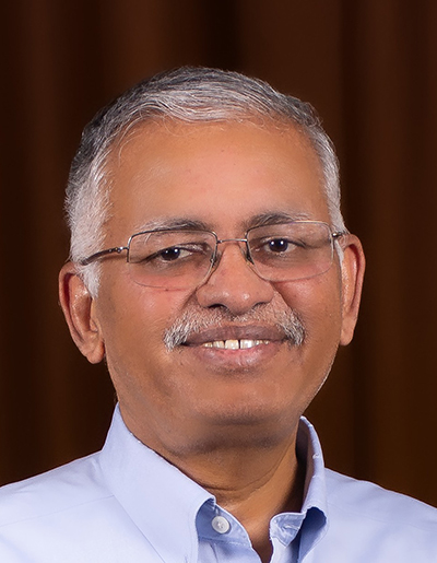
Ramesh Sivanpillai
Following the recent flood in Nepal, Ramesh Sivanpillai has taken up a familiar task -- sorting through satellite imagery and creating maps to help catalog damage and aid first responders.
As with past natural disasters, Sivanpillai, a University of Wyoming instructional professor in the School of Computing and Wyoming Geographic Information Science Center (WyGISC), was contacted by the International Charter Space and Major Disasters to help map areas damaged by the flood.
The International Charter Space and Major Disasters was formed by the United Nations in 1999, is made up of members from 17 charter countries and provides free satellite data from 270 contributing satellites to impacted regions. The organization has responded to disasters in 146 countries and has had 1,052 activations to date.
For the recent flooding in Nepal, the charter’s assistance was activated by the Department of Hydrology and Meteorology in Nepal, and a project manager was then appointed.
Under the project manager, Sivanpillai is serving as a value-added data provider (VAP) with the charter. The VAPs are analyzing imagery from space agency and private industry satellites to map damaged areas and create value-added products in the hope that first responders on the ground in Nepal can locate some of the more than 5,000 missing people.
The flash flood hit northern Nepal’s Rasuwa District the morning of Aug. 26. The flooding caused significant damage to settlements, police and customs infrastructure, hydropower facilities, markets, roads and bridges, the charter’s website says.
The cause of the flood is unknown, and more flooding is anticipated, Sivanpillai says.
“These agencies are all trying their best to get to as many people as they can, to reach out and save them,” Sivanpillai says. “So, for that, right now what I’m doing is looking at these images and saying, ‘Where can we find these damages?’”
One of the biggest challenges for creating value-added products includes seeing through cloud cover, although some VAPs use radar imagery to cut through, Sivanpillai says. Other challenges he’s encountered include a language barrier in pre-disaster maps and working around class times to analyze images and contribute maps to the charter.
“Right now, it’s a race against time,” Sivanpillai says of the effort provide value-added products to those working on the ground to rescue people and provide resources.
Sivanpillai’s strategy for creating maps is to find a satellite that other VAPs haven’t worked from and systematically work south to north through the eight provided focus areas, he adds.
Since Sivanpillai started mapping the area, the initial count of 200 images has grown
to more than 400, he says, adding that the charter benefits people such as himself
by compiling the resources and contacts of space agencies and private companies across
the globe. The organization acts as a gateway where VAPs can access images from all
the contributing agencies and begin putting together maps to help first responders.
“When a disaster happens, these private companies often put aside their paid customers’ order separately, and then they will use their resources to collect data for the disaster,” Sivanpillai says. “So, it’s a big humanitarian effort done by government agencies, private companies and so many people … All the way from Japan to the U.S., people are all working, trying to identify (areas).”
Since beginning the project, Sivanpillai has created five maps between his class times, contributing to the total of 29 maps uploaded to the system by VAPs.
“I’m hoping there are people still alive and (on-site agencies) can use these maps to get to them,” Sivanpillai says.
Sivanpillai’s previous work with the charter included working as a project manager after major flooding along the Mississippi River in 2011, an event that began in Illinois and lasted roughly five months; working as a project manager for the Camp Fire in Paradise, Calif. in 2018; working as a project manager following Hurricane Fiona in the Dominican Republic in 2022; and working as a VAP after Hurricane Milton hit Florida in 2024.
Soon, Sivanpillai will begin assessing damages to structures, similar to his work after Hurricane Milton in 2024. During that project, he enlisted the help of students and other volunteers but, because the flood happened before the fall semester began, Sivanpillai started mapping areas of Nepal on his own. As infrastructure damage assistance begins, volunteer help would be beneficial, he says.
Anyone interested in working as a volunteer to identify damaged structures and contribute to the mapping effort can email Sivanpillai at sivan@uwyo.edu.
For more information on the charter and to view maps related to the flood in Nepal, visit https://disasterscharter.org/activations/flood-in-nepal-activation-1052-, scroll down to the product section, and click “load more” when prompted to see the full selection of maps.

The University of Wyoming has earned its Research Level 1 (R1) status from the Carnegie Classification of Institutions of Higher Education, placing Wyoming's only four-year university with the top research universities in the United States.