
Assessing the Impacts of Disturbance on Sagebrush Ecosystems in the Greater Yellowstone
Cory Ott
Published October 14, 2025
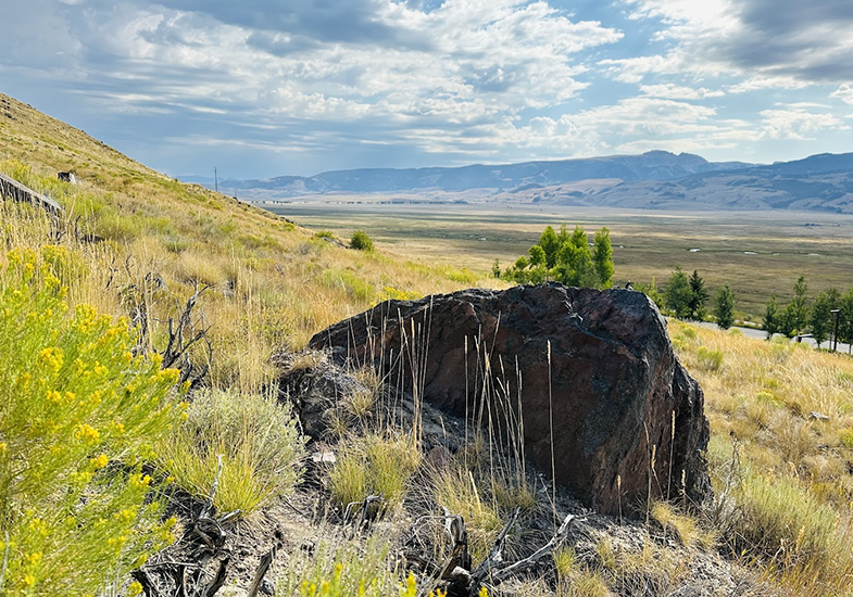
Wyoming is renowned for its expansive tracts of core sagebrush habitat across the
state, that on the surface, appear to be unchanged over the course of history. But
beneath the surface lies another side to the story, as a very complex and delicate
relationship exists between subsurface water availability and the capability of native
plant species to access it. Water is the limiting factor in semi-arid ecosystems.
These systems are facing unprecedented challenges in adapting to a rapidly changing
climate, enhanced invasive species expansion, and the ongoing legacy of anthropogenic
land use.
This is the reality that Wyoming's Greater Yellowstone Ecosystem (GYE) is facing,
and it's why researchers at the University of Wyoming are racing to understand how
these pressures alter the movement of water through landscapes that are most vulnerable
to changes in water availability. This research focuses on two complementary sites—Fire
on the Mountain and Crow Creek—to answer questions about how disturbance and environmental
changes reshape how water is cycled through semi-arid ecosystems. Our findings can
assist land managers in creating data-driven adaptive management plans to steer these
systems toward being more resilient to future environmental changes before it is too
late for them.
Fire on the Mountain: How Cheatgrass Can Rewrite the Water Cycle
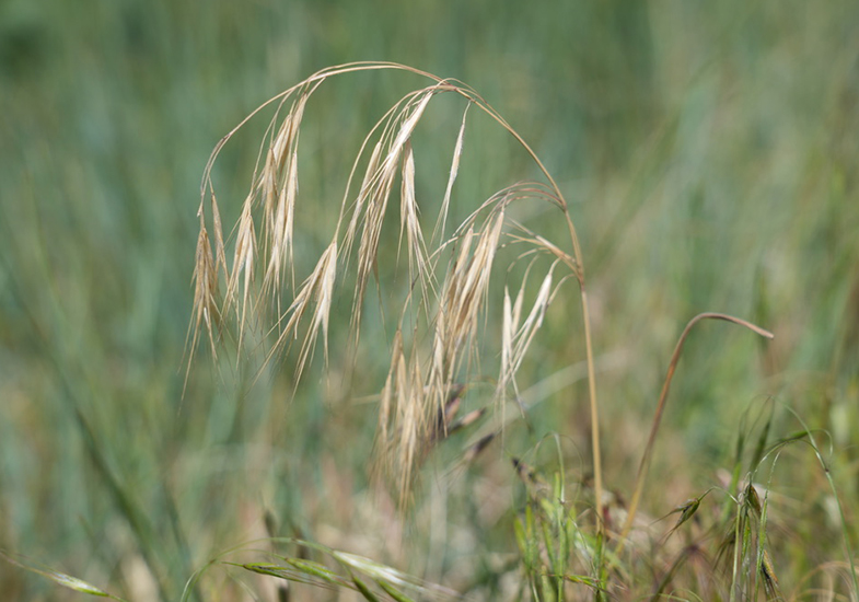
In high-elevation sagebrush environments across the GYE, a few centimeters of soil moisture can tip the balance between native plant species surviving the summer-long drought or being pushed out by an invasive annual grass. In 2019, the Museum Fire scorched a healthy sagebrush ecosystem behind the National Museum of Wildlife Art just outside of Jackson, Wyoming and set the stage for the beginnings of a cheatgrass takeover. Bromus tectorum (Cheatgrass) is known to be an early-season sprinter, as it roots itself densely in the top four inches of soil, consumes spring moisture before native perennials fully awaken from dormancy, and can even achieve two full life cycles (spring and fall) if hydroclimatic conditions are favorable for a second phase of germination. Cheatgrass also creates a negative feedback loop—more cheatgrass results in more frequent fires, which in turn favors the propagation of even more cheatgrass.
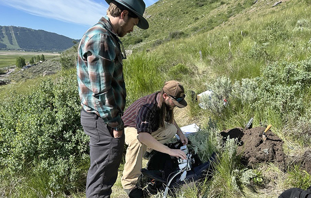
At the Fire on the Mountain site, we are measuring how different levels of cheatgrass cover alter the water budget. Using a network of soil moisture sensors, weather stations, and handheld instruments that measure plant physiology, we can track how water moves through the system—from precipitation to soil storage to plant uptake and evapotranspiration. The goal is to identify thresholds at which the proportion of cheatgrass cover fundamentally changes how water cycles through the ecosystem so that adaptive management actions can be developed to restore water availability for native species before it is too late.
We are also going to use predictive modeling to look into the future: By feeding climate projections into an ecohydrological model, we can simulate how these systems might respond to a range of warmer and drier conditions over the next several decades. Will sagebrush and other native species persist under these projected conditions, or will cheatgrass ultimately take over disturbed sites and alter the water balance for good? The answers to these questions matter for supporting everything from sage-grouse habitat to mule deer winter range.
Crow Creek: Assessing a Century-Long Legacy of Disturbance
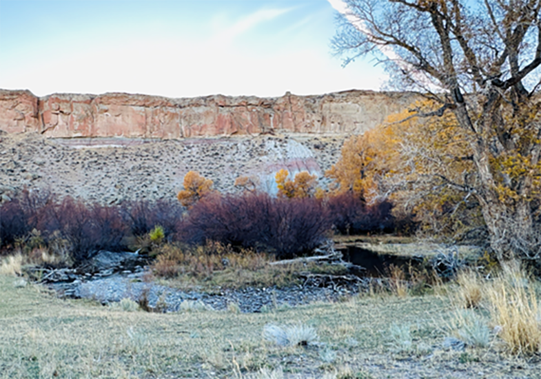
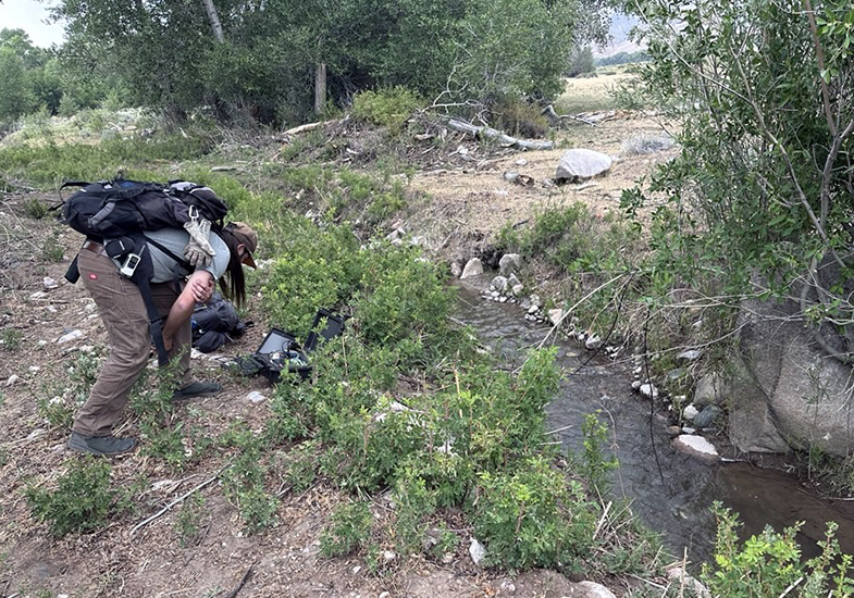
The Crow Creek project area tells a different story—one of anthropogenic disturbance, its legacy impacts on the ecosystem, and the potential for recovery. For over a century, this landscape has been shaped by intensive cattle grazing, stream diversions, irrigation, and other land use changes. The result: Severely degraded riparian areas, tainted water quality, altered stream flows, and a fractured ecosystem struggling to function cohesively as one. The culmination of these disturbances can directly alter how water is cycled through the ecosystem. It is essential to document baseline conditions of the system so that its recovery through the process of re-naturalization can be monitored and quantified as time moves forward.
Crow Creek, located in the Owl Creek Mountains, offers a rare opportunity to watch a highly disturbed system heal. We have installed monitoring equipment across four distinct eco-types—from riparian corridors to upland sagebrush—to paint a picture of how soil moisture, vegetation, and stream flow processes change over time following disturbance. This area now also serves as a living classroom and nexus for tribal community members and children to gather, learn, and reconnect to a landscape that has been out of reach. By combining field measurements with modeling efforts, we can provide tribal land managers with the tools they need to make informed decisions about where, when, and how to invest in dynamic restoration actions on the Wind River Indian Reservation.
Why This Matters
Understanding these dynamics isn't just an academic exercise; it's also about helping communities, wildlife, and ecosystems adapt to a changing climate. Both Fire on the Mountain and Crow Creek are part of WyACT's broader mission: to build the knowledge and capacity Wyoming needs to navigate climate transitions in the near future. By combining cutting-edge science with ecosystem monitoring efforts, researchers at the University of Wyoming are working to ensure that sagebrush ecosystems—and the people and wildlife that depend on them—have a fighting chance.
Watch Cory Ott talk about his Crow Creek work
The University of Wyoming has earned its Research Level 1 (R1) status from the Carnegie Classification of Institutions of Higher Education, placing Wyoming's only four-year university with the top research universities in the United States.