
This past summer, the WyomingView program crossed a major milestone. The program, which trains the next generation of remote-sensing scientists and experts, passed 100 student interns.
Since the first cohort of WyomingView interns was trained in 2004-05, the program has seen 103 student interns, most of whom have been University of Wyoming undergraduate students, says Ramesh Sivanpillai, a senior research scientist from UW’s Wyoming Geographic Information Science Center (WyGISC).
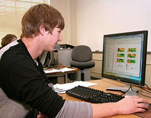
“I recruited almost all of these students from the remote-sensing classes I taught at UW,” says Sivanpillai, who directs the WyomingView program. “They have worked on a range of topics, including crop growth, rangeland monitoring, tracking changes in water bodies, and mapping wildfires and floods.”
WyomingView focuses on remote-sensing data and technologies in support of applied research, K-16 education, workforce development and technology transfer. WyomingView is part of AmericaView, a national program aimed at promoting remote-sensing science and applications. WyomingView is funded annually by the U.S. Geological Survey (USGS) and AmericaView.
Over the years, Sivanpillai says most of his student interns have come from rural counties in Wyoming as well as in 14 other U.S. states. That rural aspect is important to the lessons Sivanpillai teaches.
For example, for his fall semester class projects, Sivanpillai asked his student interns whether they had access to any crop or rangeland owned by their parents, relatives or friends. Sivanpillai gave those students Landsat and other satellite images for tracking changes in the crops or rangelands.
“They applied the concepts from the class and related them to how changes in management practices, or damages to crops, were captured in those images,” he says.
Another group of students worked with the U.S. Forest Service, the Bureau of Land Management (BLM) and other federal and state agencies fighting wildfires before enrolling in Sivanpillai’s class. After learning how satellite images can be used for mapping wildfires, some of the students contacted their supervisors and obtained specific information about the wildfires to map the impact on trees and other vegetation.
“For a brief period of time, I was able to obtain field data from a BLM field office for two students and provided them with suitable satellite images,” he says. “For those who did not have access to farms, ranches or wildfire sites, I gave them data for water bodies and inundated areas.”
During the spring semesters, some of these students returned and conducted independent research with Sivanpillai. The students expanded their understanding and use of satellites for mapping and monitoring the earth’s surface.
These student interns came from 20 UW academic majors and programs, demonstrating the applicability of remote-sensing technology and applications in several areas. Having students from diverse academic backgrounds has helped the students, the WyomingView program and himself, Sivanpillai says.
“This was such a rewarding experience for me because students were able to better relate what they were learning in lectures and labs,” he says. “Any time they had questions, they would call their parents, relatives or supervisors and ask for additional details. In several projects, the entire family was involved.”
In addition to Wyoming, student interns also have worked on projects in other states, including California, Michigan, Montana, New Mexico, Oregon, Texas and Washington.
Sivanpillai says he has received letters and emails from parents describing how the information their children or relatives generated was useful to them. One of the parents of an intern from northeast Wyoming says, “The satellite image maps have shared some valuable information concerning our 40 acres. The colored images help to confirm what we have been hoping to achieve on this acreage.”
“I have been collecting such letters and passing them along to AmericaView and the USGS. Year after year, our congressional staffers in D.C. were keenly interested to know how many students I trained and on what topics,” Sivanpillai says.
Recently, Sivanpillai has been contacting previous students and asking them how they are using the skills gained through their WyomingView internships.
Abigail Gettinger, who graduated from UW in 2020 with her master’s degree in rangeland ecology and watershed management, worked for the U.S. Forest Service as a biological science technician in soils during 2021. During that time, the native of Merom, Ind., participated on a wildfire as a burned area emergency response specialist in soils trainee.
“Knowing common remote-sensing terminology and having a background in remote sensing enabled me to act as a spokesperson for the team in pursuing an expert to better understand what factors could be influencing the map classifications,” Gettinger says. “Having the vocabulary and an understanding of the data and common practices allowed me to ask relevant questions, deepen my own understanding and share pertinent information with my team.”
Cameron Sloan, a UW graduate from Cheyenne who received his bachelor’s degree in energy resources in 2016, is now working as an environmental scientist at Herrera Environmental Consultants in Lander. Previously, he was a natural resources analyst at the Wyoming Department of Environmental Quality in Lander. Sloan says remote sensing has become a large component of his professional career.
“Through the skills that I developed with the WyomingView internship program, I am equipped with the abilities to better use satellite imagery for detecting land use changes related to mining activities,” he says.
“As an instructor, it is an absolute joy to train these undergraduate students, mostly from rural counties, on Earth observation applications using satellite data,” Sivanpillai says. “These skills are in high demand, and more companies and agencies are using these images as part of their decision-making.”
With WyGISC’s recent move to the UW School of Computing, future WyomingView interns will use machine learning methods to detect patterns and track changes across different landscapes.
“I look forward to training students in advanced methods and computing technologies,” Sivanpillai says.
For a historical snapshot of the 103 WyomingView interns, go to www.wyomingview.blogspot.com/p/interns.html.
To learn more about a dozen former WyomingView interns and what they are doing now, go to the “Then & Now” section at www.wyomingview.blogspot.com/p/then-now.html.
The University of Wyoming has earned its Research Level 1 (R1) status from the Carnegie Classification of Institutions of Higher Education, placing Wyoming's only four-year university with the top research universities in the United States.