Grasshoppers of Wyoming and the West
Entomology
Wyoming Grasshopper Population Dynamics Maps
1960-69 Grasshopper Outbreak Frequency Map
from Chapter II of Spatial Analysis of Ecological Factors Related to Grasshopper Population Dynamics in Wyoming

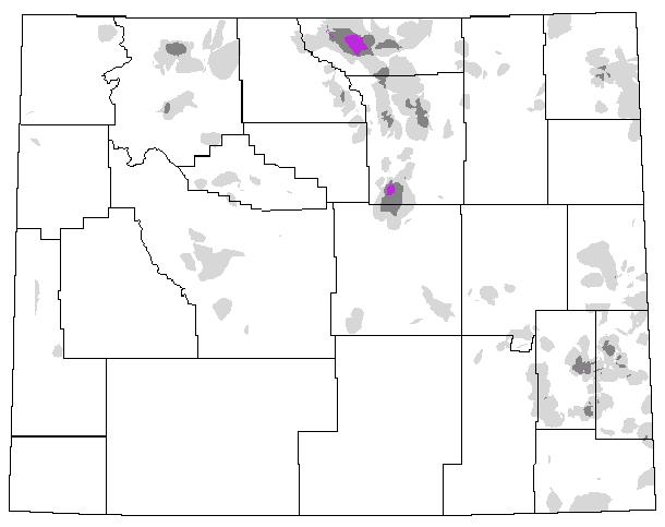
Fig. 3. Spatial distribution of rangeland grasshopper outbreaks in Wyoming from 1960 to 1969 (white = no recorded infestations; light shading = 1-2 yr infested; dark shading = 3-4 yr infested; purple = 5 yr infested; blue-green = 6-7 yr infested; red = 8-9 yr infested; black = state and county borders).
Back to Wyoming Grasshopper MapsLEARN MOREGrasshoppers of Wyoming and the West Field Guide to Common Western GrasshoppersWyoming Distribution AtlasWyoming Grasshopper Information System (WGIS)Key to Wyoming Grasshoppers Wyoming Grasshopper MapsGrasshoppers of Colorado Reduced Agent and Area Treatments (RAATs)Grasshopper LinksRangeland Grasshopper Management
LEARN MOREGrasshoppers of Wyoming and the West Field Guide to Common Western GrasshoppersWyoming Distribution AtlasWyoming Grasshopper Information System (WGIS)Key to Wyoming Grasshoppers Wyoming Grasshopper MapsGrasshoppers of Colorado Reduced Agent and Area Treatments (RAATs)Grasshopper LinksRangeland Grasshopper Management