Grasshoppers of Wyoming and the West
Entomology
Wyoming Grasshopper Population Dynamics Maps
Region definition map
from Chapter II of Spatial Analysis of Ecological Factors Related to Grasshopper Population Dynamics in Wyoming

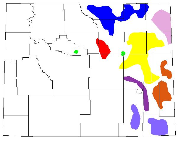
Fig. 2. Regions of interest with respect to grasshopper outbreak distribution (blue = Northern Powder River Basin; light violet = Black Hills; orange = Platte-Goshen-Niobrara Complex; purple = Laramie Mountains; magenta = Southern Big Horn Mountains; green = Midwest and Thermopolis regions; yellow = Southern Powder River Basin; light blue = Laramie-Cheyenne Plains; black = state and county borders).
Back to Wyoming Grasshopper MapsLEARN MOREGrasshoppers of Wyoming and the West Field Guide to Common Western GrasshoppersWyoming Distribution AtlasWyoming Grasshopper Information System (WGIS)Key to Wyoming Grasshoppers Wyoming Grasshopper MapsGrasshoppers of Colorado Reduced Agent and Area Treatments (RAATs)Grasshopper LinksRangeland Grasshopper Management
LEARN MOREGrasshoppers of Wyoming and the West Field Guide to Common Western GrasshoppersWyoming Distribution AtlasWyoming Grasshopper Information System (WGIS)Key to Wyoming Grasshoppers Wyoming Grasshopper MapsGrasshoppers of Colorado Reduced Agent and Area Treatments (RAATs)Grasshopper LinksRangeland Grasshopper Management