

What is Geographic Information Systems?
UW’s graduate certificate program helps students identify connections among data regarding physical locations. Using GIS, students can manage, analyze and interpret data to solve all kinds of spatial problems.
Application Deadline for Spring 2026: November 15
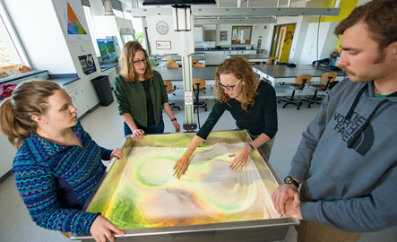
Our faculty hold active roles in the GIS industry and conduct research regarding topics
such as land use and infrastructure management.
Jeff Hamerlinck serves as Director of the Wyoming Geographic Information Science Center. He is also
active in the University Consortium for Geographic Information Science. One of his
research interests is environmental planning.
Online Learning at UW
The University of Wyoming provides a comprehensive range of fully online and hybrid programs in addition to the online geographic information systems graduate certificate. They are equivalent to in-person programs in all the ways that matter – same learning expectations, same accreditation and your transcript doesn’t differentiate how you learned. Additionally, online learners have unique needs, and we provide a suite of academic and student resources tailored to help you succeed while at UW and after you graduate.
Request InfoLearn more about the University of Wyoming's online programming!
What can you do with a graduate certificate in Geographic Information Systems?
A graduate certificate in Geographic Information Systems (GIS) equips you with in-demand skills in mapping, spatial analysis and data visualization. It’s a valuable asset for careers in environmental consulting, urban planning, natural resource management, public health, logistics and more. Whether you're looking to advance in your current field or explore new opportunities, this certificate can give you a competitive edge in industries that rely on location-based data.
- GIS analyst or technician
- Urban or regional planner
- Environmental consultant
- Cartographer
- Remote sensing specialist
- Natural resource manager
- Public health or emergency response analyst
- Transportation or logistics planner
- Market research or site location analyst
Industries that rely on GIS include government, environmental science, urban planning, public health, utilities, agriculture, disaster management and business analytics. The certificate can also enhance your qualifications for graduate school or promotion within your current field.
Earning a GIS certificate offers several key benefits. It builds specialized, in-demand skills in mapping, spatial analysis and geospatial technology that are valuable across industries. The certificate can boost your resume, help you transition into a GIS-related role or advance in your current career. It’s also a flexible way to gain practical, job-ready experience without committing to a full degree program—making it ideal for working professionals or recent graduates looking to stand out in fields like environmental science, urban planning, public health or business analytics.
A career in Geographic Information Systems (GIS) is dynamic, data-driven and highly versatile. GIS professionals use mapping software and spatial analysis tools to solve real-world problems—like tracking environmental changes, planning city infrastructure or optimizing emergency response. The work often involves collecting and analyzing geographic data, creating digital maps and using location intelligence to support decision-making. Careers in GIS can be found in government, environmental consulting, public health, transportation, urban planning and even retail and marketing. It’s a great field for detail-oriented problem solvers who enjoy working with data, technology and real-world applications.
Want to learn more about the Wyoming Geographic Information Science Center (WyGISC)?
WyGISC is an interdisciplinary institute at the University of Wyoming dedicated to advancing geospatial science and technology through research, education and outreach. We develop and apply geographic information systems (GIS) to address real-world challenges, with a mission to lead in geospatial innovation, education and service across the university, state and region.

The asynchronous delivery of the GIS program at UW makes this a perfect certificate for busy professionals looking to expand their knowledge in geospatial technology and science.
The University of Wyoming has earned its Research Level 1 (R1) status from the Carnegie Classification of Institutions of Higher Education, placing Wyoming's only four-year university with the top research universities in the United States.