
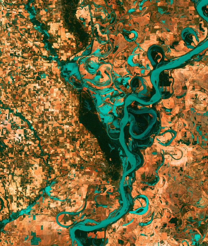
What is Remote Sensing?
Remote sensing data provides insights on systems and locations for applications ranging from meteorology and environmental science to crisis prevention due to natural disasters. The remote sensing field lends itself to solving unique challenges due to the broad quantity of data available for analysis from systems such as satellite imaging, aerial photography and even ground-based mobile and stationary sensors.
Application Deadline for Spring 2026: November 15

Our faculty have the expertise to inform students of theoretical information and prompt
them to make real-life applications.
Paddington Hodza is a Senior Research Scientist who researches a range of topics including UAS, positivity
GIS and immersive geo-visualization.
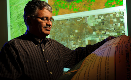
Dr. Ramesh Sivanpillai specializes in remote sensing, with expertise in research, teaching, and service
and outreach in this field.
Online Learning at UW
The University of Wyoming offers a comprehensive selection of fully-online and hybrid programs, in addition to the online remote sensing graduate certificate. These online programs are on par with their in-person counterparts in terms of learning standards and accreditation. Recognizing the distinct requirements of online learners, we furnish a range of academic and student resources designed to support your success both during your time at UW and in your post-graduation journey.
Request InfoLearn more about the University of Wyoming's online programming!
What can you do with a Remote Sensing Graduate Certificate?
Remote sensing scientists analyze images and other data to solve problems across disciplines. Applications like Google Earth and satellite-based maps are familiar to all of us, but they only hint at the utility of remotely sensed data. Expertise in remote sensing can be applied to fields ranging from anthropology to zoology, and trained remote sensing scientists work in academia, private industry, and local, state, and federal agencies.
- Manufacturer
- Technical Service Provider
- Utilities
- Public Administration
- Educator
- Remote Sensing Analyst
- Geospatial Analyst
- GIS Specialist
- Environmental Scientist
- Natural Resource Manager
- Urban and Regional Planner
- Agriculture Specialist
- Cartographer or Mapping Technician
- Remote Sensing Software Developer
- Remote Sensing Project Manager
Here are a few places where remote sensing alumni have made a difference:
- State of Wyoming
- Hager Environmental and Atmospheric Technologies
- Air Care Colorado
- California Institute of Technology
Yes, remote sensing can be a very good career, especially if you’re interested in technology, environmental science, geography or data analysis. It plays a critical role in fields like climate science, natural resource management, agriculture, urban planning and national security. As industries increasingly rely on satellite imagery, drones and geospatial data to make informed decisions, demand for remote sensing specialists continues to grow. It’s a career path that combines scientific research, problem-solving and cutting-edge tech—often with opportunities for meaningful, real-world impact.
Yes, remote sensing does require specialized training—but that’s exactly what our certificate program is designed to provide. Whether your background is in environmental science, geography, engineering or a related field, a remote sensing certificate gives you hands-on experience with tools like GIS, satellite imagery and drone data. You’ll learn how to analyze geospatial information and use industry-standard software. A certificate is a great way to build expertise, boost your resume and open doors to careers in natural resources, urban planning, climate science and beyond.
Advance Your Career from Anywhere
Ready to map your future? A remote sensing certificate from UW gives you the skills to track wildfires, floods, agriculture and more—100% online. Apply now and take your career to the next level!
The University of Wyoming has earned its Research Level 1 (R1) status from the Carnegie Classification of Institutions of Higher Education, placing Wyoming's only four-year university with the top research universities in the United States.