
Current Enterprise Data Layers
- Emergency Phones
- Automated Defibrillator Units (AED)
- Real Estate Operations:
- Improvements (buildings, parking lots etc.)
- Current real property holdings
- Leases
- Easements
- Landscaped Areas
- Parking
- Physical Plant Utilities:
- Electrical
- Gas
- Water
- Wastewater
- Stormwater
- Irrigation
- Condensate
- Lighting/Light Poles
- Bike Paths
- Donated Features and Art
- Survey points
- Shuttle Routes
- Space Management:
- Building Interior Spaces
- Building Floor Plans
- Building Floor Plan Lines
- Trees
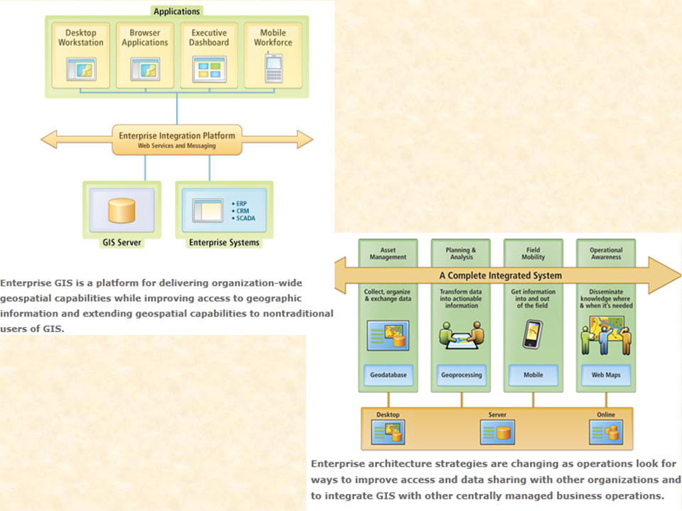
Enterprise GIS is an Integrated System
Administration Map Gallery
 |
 |
 |
 |
The University of Wyoming has earned its Research Level 1 (R1) status from the Carnegie Classification of Institutions of Higher Education, placing Wyoming's only four-year university with the top research universities in the United States.