
Learn more:
WyGISC GeoData Portal:
The GeoData Portal is specifically designed to allow access to secure web applications developed by WyGISC for our partners.
Partners, please take a few minutes to register with GeoData Applications if you are a new user.
Once your account is created, you will simply be asked to log in during future visits to the site.
UW Operations Enterprise GIS More Information:
Benefits of an Enterprise GIS:
- Real-time Data,
- Scalable,
- Better decision-making via geographic approach,
- Combining related legacy data,
- Effective Communication,
- Improve Workflows
Enterprise GIS: Application of GIS to meet the broad needs of an enterprise
-
Uses a common infrastructure for building and deploying GIS solutions,
-
Extends geospatial capabilities to an enterprise community
-
Improves capabilities of other enterprise systems by leveraging the value of geographic information,
-
Increases overall operating efficiency and collaboration using GIS across your organization,
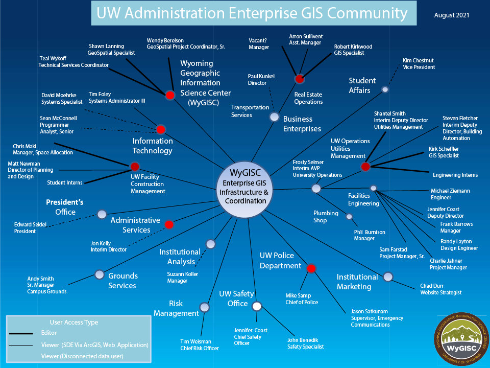
WyGISC Work with Administration (Non-Academic Units):
How is UW Currently Using and Sharing GIS Maps and Data via the Enterprise?
-
Multiple access options:
-
Direct Access and editing of the GIS database to authorized users,
-
Extract spatial data from data servers and provide it to others as requested,
-
View data live through password-protected web applications,
-
Provide secure live data services,
-
-
WyGISC application, data, and web servers at Information Technology Data Center (cloud).
Web-based Applications and Maps Using UW's Enterprise GIS
Below are examples of the secure portal applications or live data services.
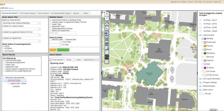
The REV, a custom application available through a secure website, provides access to UW's Real Property holdings and related information.
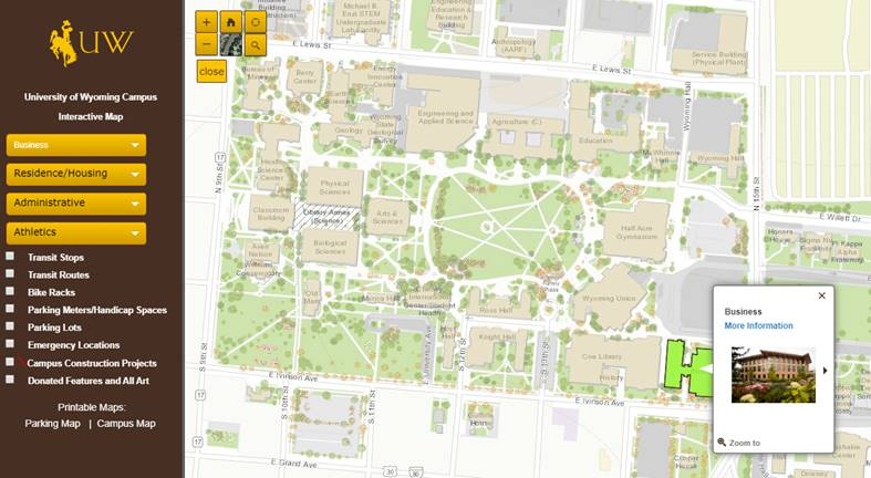
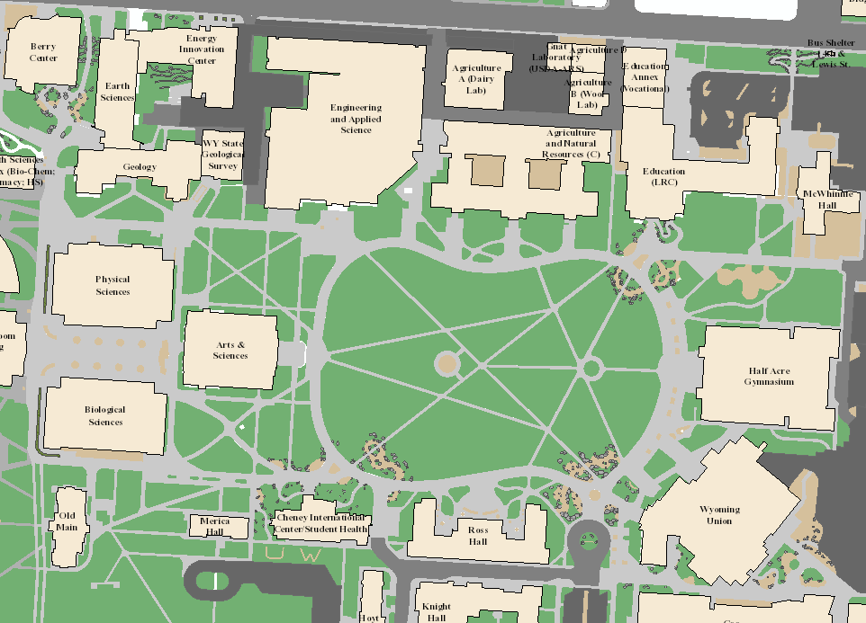
Working with Institutional Marketing, WyGISC provides real-time data for the Campus Map on UW's website. Map
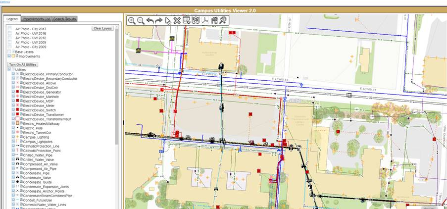
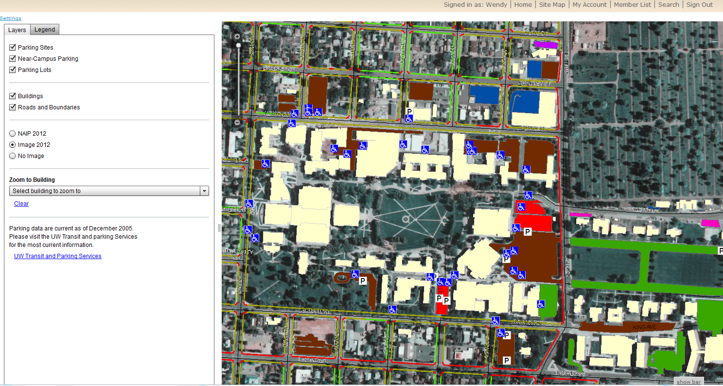
The Utilities Data Viewer, a custom application available through a secure website, provides access to detailed utility data and location information.
The Campus Control Network, a custom application available through a secure website, provides access to survey control point details and information.
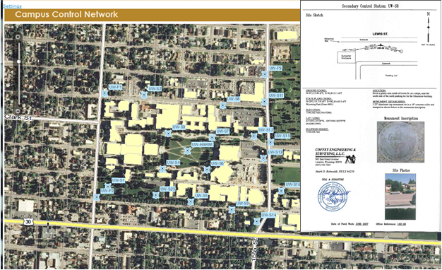
The Campus Control Network, a custom application available through a secure website, provides access to survey control point details and information.
This data can be used by other application via web services. UW has entered into an agreement with ESRI to provide basedata for campus via the Living Atlas of the World/World Topographic Map program. Data is updated annually.
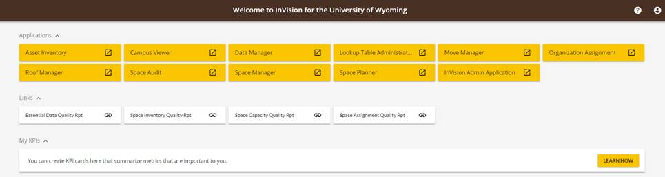
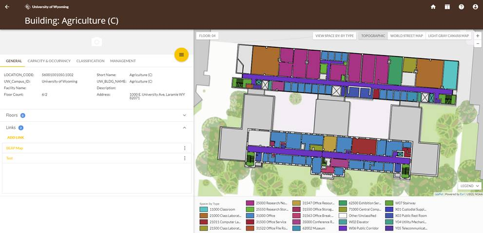
When fully launched, InVision will provide for viewing and managing spaces use on campus via secure web based applications. InVision by PenBay (BETA)
Retired Projects
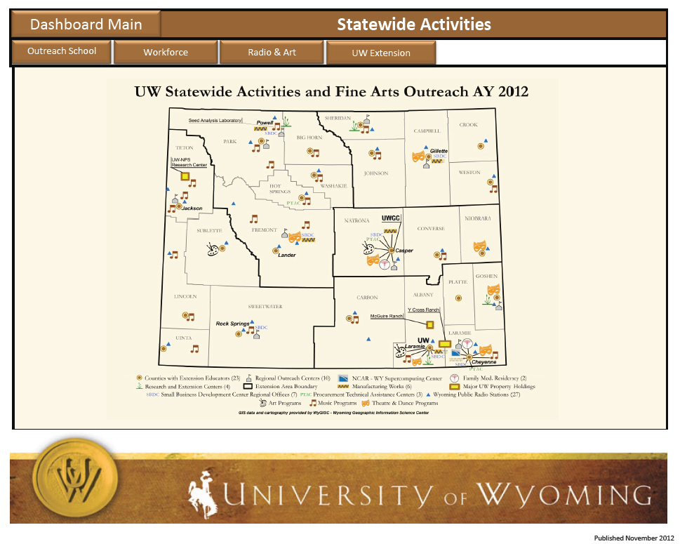
Maps using EGIS data are provided for UW's Dashboard. The University of Wyoming Dashboard is a visual interface that provides at-a-glance views into key measures for students, faculty and staff, tuition and fees, research, budget, and statewide activities. Just open the document and click the brown buttons to navigate throughout the dashboard.
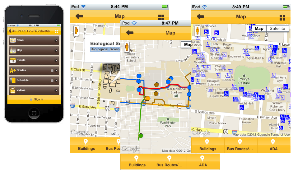
Information Technology's WyoMobile uses data from the Enterprise GIS.
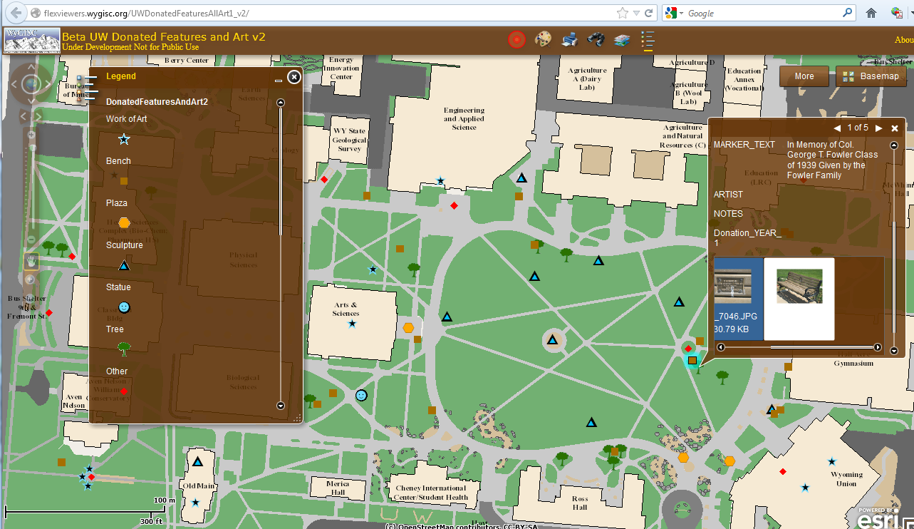
This is a demonstration application showing locations of some features donated to the university as well as university art. This application and associated data are currently under development.
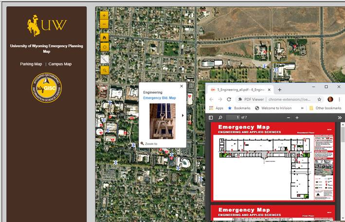
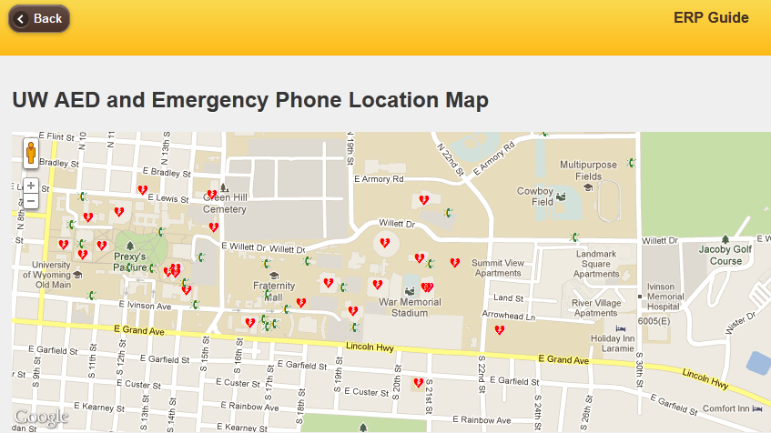
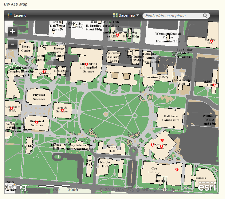
UW's Emergency Response Plan includes mobile-ready web pages as well an interactive map that pulls data from the Enterprise GIS. These pages were developed through a cooperative effort between WyGISC, Information Technology, Administration and Public Relations.
This application is in beta form, and we recommend checking with Transit and Parking Services for the most up-to-date construction closures for parking.
The Enterprise GIS provides data for Environmental Health and Safety's Automated External Defibrillator (AED) location map.
Enterprise GIS On Other Campuses
GIS In Education: Across Campuses and Inside Facilities, August 2012. This book contains best practice examples of the application of GIS for administration in various educational settings. The articles are organized into three groups - planning and portfolio management, operations and maintenance and security, compliance, and sustainability.
University of Calgary, Centralized Mapping Services. They also have an Interactive Room Finder Map. Building a University of the Future, University of Calgary. News story from ArcNews Winter 2011/2012.
University of New Hampshire, Campus Planning GIS has browser based Campus Accessibility Map.
University of Georgia, Office of University Architects - GIS Mapping Project. This site is full of links to a rich set of campus content; an interactive campus map, historic maps, planning maps, transit maps, and a host of other resources.
UC Davis Campus Care. This site is an index of many projects to which UC Davis applies GIS. One of the interesting items here is a GIS Services work order creation system. Also check out the links at the bottom of the page in the Administrative & Resource Management Organization pane.
Western Kentucky University, Office of Planning, Design and Construction - GIS/GPS Services. On this site there are links to a map of the main campus, a campus bus stop and bike rack map, and a map of campus emergency phones. There is also another cool link; a pdf document that details their approach to using GIS complete with their mission, experience, current tasks and future plans.
MIT Department of Facilities. On this site one of the useful items is a pdf of MIT’s guidelines to using spatial data and to its value in building interior space management (BIM).
The University of Wyoming has earned its Research Level 1 (R1) status from the Carnegie Classification of Institutions of Higher Education, placing Wyoming's only four-year university with the top research universities in the United States.