Skip to Main Content

Apply Now to the University of Wyoming apply now

Grasshoppers of Wyoming and the West

Entomology

Wyoming Grasshopper Population Dynamics Maps

Region definition map

from Chapter II of Spatial Analysis of Ecological Factors Related to Grasshopper Population Dynamics in Wyoming

Fig. 2. Regions of interest with respect to grasshopper outbreak distribution

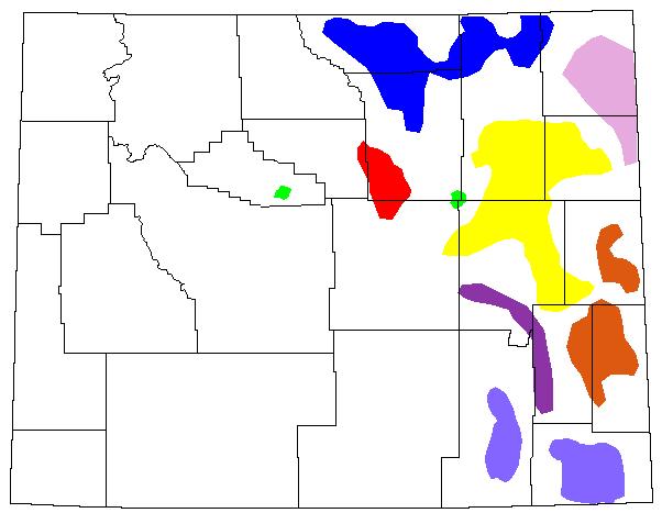
Fig. 2. Regions of interest with respect to grasshopper outbreak distribution (blue = Northern Powder River Basin; light violet = Black Hills; orange = Platte-Goshen-Niobrara Complex; purple = Laramie Mountains; magenta = Southern Big Horn Mountains; green = Midwest and Thermopolis regions; yellow = Southern Powder River Basin; light blue = Laramie-Cheyenne Plains; black = state and county borders).

Back to Wyoming Grasshopper Maps
Contact Us

Scott Schell

Room #9, Agriculture Bldg.

Phone: (307) 766-2508

Email: insectid@uwyo.edu

1000 E. University Ave. Laramie, WY 82071
UW Operators (307) 766-1121 | Contact Us | Download Adobe Reader

Accreditation | Virtual Tour | Emergency Preparedness | Employment at UW | Privacy Policy | Harassment & Discrimination | Accessibility Accessibility information icon