Nulclear Magnetic Resonance (NMR) or Ground Magnetic Resonance (GMR)
NMR Overview:
NMR is the only geophysical measurement that is directly and unambiguously sensitive to water.
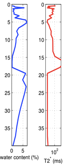
It detects groundwater using the same physics as a medical MRI scanner, but uses the Earth’s magnetic field in place of the much stronger magnetic field generated inside an MRI magnet. NMR measurements can be either on the surface or in well bores. In the geomagnetic field, hydrogen nuclei in groundwater will emit a measurable NMR signal when they are energized at a specific resonant frequency. This NMR signal provides information about the abundance of water and the size of the pore spaces in which the water resides. In a GMR survey, the NMR response of groundwater is probed using large wire loops (up to 200 meters on a side), which are laid out on the surface. Short current pulses are routed through one or more of the wire loops to energize the hydrogen nuclei in groundwater at their resonant frequency (1–3 kHz, depending on location). Following the transmit pulse and a short delay, known as the dead-time, the surface loop(s) switch to receive mode and record the NMR signal generated by the energized groundwater. Repeated measurements achieve varied depths of investigation by increasing or decreasing the amount of energy through the surface coils. Advanced signal processing techniques are used to cancel environmental and cultural noise. An advanced, high-resolution linear inversion is implemented to isolate the NMR signals arising from groundwater at different depth locations. Using these isolated NMR signals, the spatial distribution of water content can be directly and quantitatively derived from the signal amplitude.

