
UW Trustees Approve Launch of Geospatial Information Science Degree Programs
Published June 11, 2020
The University of Wyoming will offer new degree and certificate programs to meet changing student demands and workforce needs, following action by the UW Board of Trustees.
The board voted Wednesday to approve two new interdisciplinary degree programs and five certificate programs in geospatial information science and technology (GIST). The offerings will be coordinated by the Wyoming Geographic Information Science Center (WyGISC). The newly established programs will help meet the needs of Wyoming and regional economies by producing graduates who can work in a variety of fields, including science, education, government and business.
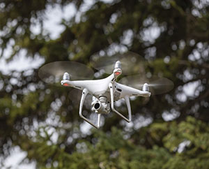
The new programs include two undergraduate certificates, one in geographic information science (GIS) and one in remote sensing; three online graduate certificates, in GIS, remote sensing and unmanned aerials systems (drones); and a Master of Science degree in GIST (online with no thesis required). In addition, a Bachelor of Science degree in GIST will be launched in fall 2022.
Students may begin enrolling in the programs this fall. Applications for graduate credentials will be accepted starting July 1. For more information, go to www.uwyo.edu/wygisc/academics/.
As the state’s flagship, land-grand institution, UW has a responsibility to citizens to provide educational outcomes that directly affect the economic well-being of Wyoming.
“Geospatial science answers place-based questions that can be asked across disciplines, from economics to ecology, anthropology to zoology,” WyGISC’s GIST Program Director Ken Driese says. “This field includes GIS, GPS, remote sensing and unmanned aerial systems, or drones, and it is growing rapidly.”
“Over the last three years, we’ve engaged with both government and industry in the state and region to design a set of credentials that will meet the workforce needs and demands associated with geospatial data skills and competencies in a wide range of employment sectors,” WyGISC Director Jeff Hamerlinck says.
WyGISC was established in 1996 as an interdisciplinary research center focused on development of geospatial information and technologies and their applications in science, education, government and business. In December 2017, the Provost’s Spatial Sciences Initiative Task Force recommended that WyGISC lead the development of a cross-college interdisciplinary GIST program to deliver undergraduate, graduate and professional GIST curricula.
Nationwide, GIST undergraduate degrees are among the most employable and in-demand degrees, according to the U.S. Bureau of Labor Statistics. A recent study of employers in the Rocky Mountain region found that nearly 75 percent anticipated growth in GIST-related activities in the next five years.
The Bureau of Labor Statistics also reported that employment for GIST professionals is expected to grow 19 percent from 2016-2026, faster than average growth (7.5 percent) in other occupations.
The University of Wyoming has earned its Research Level 1 (R1) status from the Carnegie Classification of Institutions of Higher Education, placing Wyoming's only four-year university with the top research universities in the United States.