
About the Remote Sensing Undergraduate Certificate
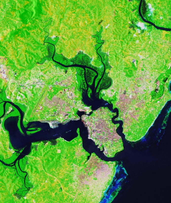
The remote sensing certificate program gives students the opportunity to learn how to use and interpret imagery acquired from aircraft, satellites or ground-based platforms. In this program, students take 9 credit hours of courses. This includes one required course and your choice of electives.
This certificate can be added to any major using the change of major form available on the registrar office's website.
Why pursue a remote sensing certificate?
The remote sensing certificate is a wonderful way to add marketable skills to any UW degree, particularly in the STEM fields. Students are trained in how to use and interpret imagery acquired from various aircraft and satellites, and graduates are prepared to use their skills in the real world.
- Remote Sensing Project Manager
- Environmental Scientist
- Utilities
- Public Administration
- Educator
- Remote Sensing Analyst
- Geospatial Analyst
- Technical Service Provider
- Environmental Scientist
- Natural Resource Manager
- Urban and Regional Planner
- Agriculture Specialist
- Cartographer or Mapping Technician
- Manufacturer
- Remote Sensing Software Developer
- GIS Specialist
- Federal agencies (e.g., NASA, USGS, NOAA, EPA, NPS, FEMA): Employ remote sensing to monitor land use, natural disasters, climate change, and environmental health.
- Aerospace and defense organizations.
- Technology companies (e.g., Esri, Google, Apple, Microsoft)
- Conservation organizations (e.g., The Nature Conservancy, World Wildlife Fund):
- Precision agriculture companies.
- Academic and research institutions
- Insurance and finance firms
To become a remote sensing specialist, start by earning a degree in a related field
like geography, environmental science or computer science, then build your skills
with tools like GIS, satellite imagery software and coding in Python or R.
Adding a remote sensing certificate provides hands-on training that sets you apart.
Internships or research projects can give you valuable real-world experience, and
staying current with new technology helps you stay competitive in this fast-growing
field.
A career in remote sensing offers the chance to work at the intersection of technology, science and real-world problem solving. You’ll use cutting-edge tools like satellite imagery, drones and GIS to monitor environmental changes, support disaster response, manage natural resources and guide smart decision-making in fields like agriculture, urban planning and climate science. It’s a fast-growing field with strong job prospects, opportunities for innovation and the ability to make a meaningful impact on global and local challenges.
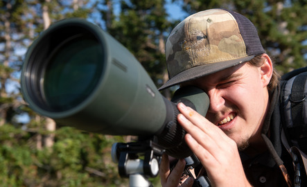
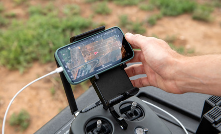
Where Drones and Data Drive Discovery
See how students at the University of Wyoming are taking their education to new heights! Our GIS and remote sensing students learn to operate drones and collect real-world data to solve complex environmental and land-use challenges. If you're interested in remote sensing, mapping or using cutting-edge tools to understand the world, this certificate is a great addition to any degree.
The University of Wyoming has earned its Research Level 1 (R1) status from the Carnegie Classification of Institutions of Higher Education, placing Wyoming's only four-year university with the top research universities in the United States.