
Alliance and Member News
Past Events
May 20, 2023
-
Presentation to University of Northern Colorado Hewit Institute: Teaching Sustainability in the 21st Century. Margo Berendsen demonstrated how to involve students in data collection using interactive maps with examples from the Wyoming Student Atlas.
August 8-10, 2023
-
Story maps from the online Wyoming Student Atlas were presented at the 14th annual Native American Education Conference at Central Wyoming College in Riverton, along with related teaching toolkits developed by WyoHistory.org.
Sept 2022
-
WyoHistory.org published an article about how Wheatland Middle School teacher Mary Jo Birt uses the giant Wyoming floor map with her 7th grade students. "Inspired by Grace Raymond Hebard and fueled by resources like the new interactive map of the state's historical markers, students choose a marker and research the information behind it. They then place 3-D models they've made of the markers on the large Wyoming map".
June 2022
-
Margo Berendsen presented the Wyoming Student Atlas to 50+ Wyoming educators at the Wallop Professional Development Workshop 2022 for social studies and civic engagement.
July 2021
-
The University of Wyoming and Wyoming Geographic Alliance offered an online course for teachers called Exploring NE Wyoming's Native Americans, National Parks and Natural Resources. The course featured Donovin Sprague, Cheyenne River Sioux, Lakota Historian talking about natural and cultural features of Northeast Wyoming and the Black Hills (videos, images and maps have been incoporated in this new Wyoming Student Atlas story map). The course also featured Jo Shiller, Casper 4th grade teacher who presented the Junior Ranger Guide, a Google slide show that her students create on Native Americans, a game she created for packing a wagon for a trip on the Oregon Trail, and an ABCs of WY book that she creates at the end of each year.
August 2021
-
Germaine Wagner presented the giant floor maps and Wyoming Student Atlas at the 2021 Native American Education Conference, August 11-14, 2021 (virtual) and at the Wyoming Innovations in Learning conference, Sept 30-Oct 1, 2021 (virtual).
August 2020
-
Germaine Wagner presented the giant floor maps and Wyoming Student Atlas at the 2020 Native American Education Conference, August 5 & 6 (virtual).
-
Tom Rea with WyoHistory.org presented a new middle grade lesson on Native American history in Wyoming, using the online Wyoming Student Atlas at the 2020 Native American Education Conference August 5 & 6 (virtual).
January 2020
-
Riverton, WY WDE- state social studies conference - focus on GIS, Nat Geo, Native Am, Civics - WGA will be integral in sharing map and atlas lessons (Jan. 9-10, 2020)
-
The 2020 Wyoming GeoBee in Casper was canceled but we are looking forward to 2021!
November 2019
-
November 6-8 2019. Germaine Wagner and Margo Berendsen presented the giant floor maps and interactive map activities based on the Wyoming Student Atlas at the Wyoming Innovations in Learning conference.
-
November 22-24, 2019. NCSS/NCGE - Austin, Texas - history of energy in Wyoming with Peter Moran and Germaine Wagner.
September 2019
-
Equity & Literacy Instruction Literacy Conference (Laramie) - using books on WY floor map with grid system lessons.
-
WGA loaned the GTM North America to Sacajawea Audubon, Bozeman, MT for a lesson on bird migration and plastics - 250 participants.
-
David Street Station- lunch on the lawn series: GTM North America, GTM Wyoming and place- based scavenger hunt learning about the community - WGA provided incentives for completed cards, designed for parent and child involvement.
July and August 2019
-
Native American Education Conference - GTM Wyoming and Wy floor maps, Riverton - (bison feeding excursion), educational incentives for student welcome bags, 35 active and enthusiastic participants for both map sessions.
-
STEAM conference - Wyoming floor maps and various lessons - Laramie, WY. 14 educators, very interested in the atlas and map lessons!
June 2019
-
Biodiversity and Geo Inquiry for educators - 1 credit class held in Casper with 25 teachers attending, Tina Melin and Sarah Hackworth presented the geo-inquiry process with a focus on migration and light pollution.
-
WGA co-sponsored with QFI (Qatar Foundation International) The Choices Program Brown University- Explore the Past... Shape the Future, History and Current Events for the Classroom, "Immigration, Nigeria, Middle East, Afghanistan and Contested Issues" class held in Casper, 10 attended (5 out of state).
March 29, 2019
-
Dillon Davis, an eighth grader from Lincoln Middle School, in Green River, WY, took top honors at the 2019 National Geographic GeoBee Wyoming State Competition at Casper College. Davis will advance to the national competition, which will be held at National Geographic Society headquarters in Washington, D.C., from May 19 to 22, 2019. See the Wyoming GeoBee State Competition page for more results, photos and information about this event.
January 2019
-
Margo Berendsen piloted two new place-based learning activities using the online version of the Wyoming Student Atlas at Wyoming schools. Natural hazards (earthquakes, landslides, tornados and floods) based on NGSS and Wyoming science standards was piloted at Casper Classical Academy, seventh grade science; Comparing Wyoming and Mars was piloted at UW Lab School, Laramie; middle school grade social studies. This activity explored what drew settlers to Wyoming originally and challenges they faced compared to potential challenges to colonizing Mars; how society utilizes physical features/natural resources, like uranium and geothermal.
November 12-16, 2018: Geography Awareness Week and GIS Day
-
Over 400 students explored the giant Wyoming floor map for GIS Day at McCormick Junior High, an event coordinated by Wyoming Game and Fish Department, Wyoming Department of Environmental Quality, Laramie County/City of Cheyenne GIS Cooperative, McCormick Social Studies Department.
-
Michele Haas and Margo Berendsen piloted standards-based science lessons plans with 140 seventh graders at Casper Classical Academy based on activities with the online Wyoming Student Atlas (November 7: Weather Forecasting and November 15: Winds and Currents). Margo Berendsen also piloted a standards-based social studies lesson plan, How have physical features/natural resources influenced historical events in Wyoming, with 45 sixth graders at Tongue River Middle School (October 30).
October 29, 2018: National Geographic Education Summit for Georaphy Stewards - Washington DC
-
J.J. Shinker is attending this summit that will showcase the many ways National Geographic is enhancing teaching and learning in classrooms across the country.
October 15-16, 2018: Math and Science Teacher's Conference - Casper, WY
-
Germaine presented the Wyoming Student Atlas and floor map to 29 enthusiastic teachers
August 6-10, 2018: National Council for Geographic Education - Quebec City
-
Germaine Wagner received an award for "Outstanding Support for Geographic Education"
-
Peter Moran and Germaine Wagner presented "America's Energy Treasure Chest, the Geography of Energy in Wyoming" using floor map. Several global participants (New Zealand, South Korea, Swaziland) were very engaged with our approach.
August 1-3, 2018: STEAM conference in Gillette, WY
-
Kelly Hawkinson represented the Wyoming Geographic Alliance and showcased the online Wyoming Student Atlas and lessons on WY floor map. Approximately 87 people attended the share-a-thon Digital Wyoming Student Atlas review.
August 8 & 9, 2018: Native America Conference Riverton
-
Jessica Flock, Gabe Swarts and Rob Black represented the Wyoming Geographic Alliance
July 16-21, 2018: National Geographic 2018 summer institute, Teton Science School near Jackson, Wyoming
-
Kristina Melin, Big Horn Middle School and Sarah Hackworth from Sheridan
July 11-13, 2018: Wyoming Energy Education Initiative (WEEI) Casper
-
Curriculum development to bring energy education into the classroom, with a focus on place based learning where each school would have unique curriculum to fit the town where it is being taught
-
Focusing on 4th-8th social studies and science
-
WGA was represented by Peter Moran and Germain Wagner and presented the Wyoming floor map and Wyoming Student Atlas.
-
The elementary session focused on where the energy resources are located in the state. The middle/high school session focused on the history of energy in Wyoming. Participants then viewed the maps that the other group had created to gain more ideas. Several teachers requested the floor maps for their schools after these interactive lessons. Therefore, an additional 7 maps were ordered.
July 11-13, 2018: National Geographic 2018 Summer Institute at Teton Science Schools
-
Kristina Melin was selected by National Geographic to represent Wyoming
July 9-10, 2018: Geo-Inquiry Process Summer Institute in Casper, WY
-
The focus was to introduce teachers to the NatGeo Geo-Inquiry Process using the phases: ask questions, collect data, visualize outcome, create a solution to the question, and act by sharing the results of the project with an audience.
-
The process was taught by Michele Haass and Shelley Diehl, the two Wyoming teachers WGA selected to receive training at Nat Geo headquarters last summer.
-
Guest speakers included Katie Simpson from the Wyoming Game and Fish who presented an interactive ecology lesson on how hard it is to be a fish (salmon). Zach Hutchinson from Audubon Rockies shared hands-on sagebrush habitat lessons complete with pelts and skulls of animals.
-
Germaine shared the Wyoming floor map and the Digital Wyoming Student Atlas as well as the sampler geo-inquiry packs from ESRI in various content areas. Rica Fulton, UW grad student, showed a lesson on water education. Teachers were provided the Wyoming Student Atlas for classrooms.
July 9-10, 2018: AP Human Geography Professional Development, Laramie, WY
-
J.J. Shinker, director of the Wyoming Geographic Alliance, hosted an Advanced Placement Human Geography Workshop at University of Wyoming, exploring how core geographic concepts set forth in the AP Human Geography course outline - region, pattern, place, space, and scale - provide insight into fundamental developments unfolding around the world.
-
Presentation on how to use the digital Wyoming Student Atlas to enhance AP Human Geography units with information specific to Wyoming
June 11-15 and June 18-22, 2018: Summer Odyssey at UW Lab School, Laramie, WY
-
WGA presented Wyoming floor map and atlas with Ashley Koch for 36 students
-
WGA also presented the Wyoming floor map and digital Wyoming Student Atlas lessons at Oregon Trail Elementary School in Casper for 70 fourth grade students
January 2018: new online version of the Wyoming Student Atlas released
An online version of the Wyoming Student Atlas is now available at atlas.wygisc.org. The online version is available in three formats
-
A digital pdf flipbook version of the paper Atlas.
-
Story maps which explore 38 different themes from the Atlas in more detail and with interactive maps, appropriate for 4th-8th grade science and social studies activities.
-
Web map versions of all the maps in the paper Atlas which can be modified and added to. Some are also available in kmz format for Google Earth.
December 2017: Wyoming Student Atlas
Margo Berendsen presented the digital version of the Wyoming Student Atlas, atlas.wygisc.org at three schools:
-
Beitel Elementary, 20+ 4th graders (Laramie)
-
Park Elementary, 16 4th graders (Casper)
-
Laramie Middle School (100+ 6th grade students in Earth Science classes)
Summer, 2017
Our 2017 Summer Institute "Geography, at the Intersection of Art and Literature" featured a four part lecture series with Cat Urbigkit, Gene Gagliano, Zachary Pullen, and Dr. Julie Francis. Our summer workshops offer a limited number of travel scholarships to help pay for lodging and mileage reimbursement and educators attending are eligible for 1.5 WY PTSB credits and 1 UW Outreach Graduate Credit.
April 1, 2016 (Casper, Wyo.)
Thirty-six students from around Wyoming competed in the 28th State Geography Bee in Casper. Any school in Wyoming that has students in grades 4-8 are eligible to register for the Geography Bee.Six students must participate and one will take a qualifying test that is scored by National Geographic. The school winners are then invited to the State Bee. Wyoming has the fewest participants nationwide and more students are needed to have this opportunity. Each State Bee can host 100 students. Winners of the Wyoming Bee were:
-
1st place: Degory Day, 7th grade - Evanston Middle School (he is the one praying in the top 10)
-
2nd place: Conrad Keevert, 8th grade - Lander Valley Middle School
-
3rd place: Preston Buehler, 6th grade - Osmond Elementary - Thayne
Degory received $100, the National Geographic book "The National Parks: An Illustrated History" and a medal. He will will advance to the nationals in Washington, DC on May 22-25. The national champion will receive a $50,000 college scholarship and a lifetime membership to National Geographic Society.
One of the championship round question that was relevant to the 4-8th grade competitors was: In the newest Star Wars movie, The Force Awakens, desert scenes of the fictional planet of Jakku were filmed in a country that borders both Oman and Saudi Arabia. Name this country on the Persian Gulf.
Both of the boys in the championship round answered correctly - United Arab Emirates.
Great job Wyoming Students!
March 29, 2016
2016 STUDY CANADA Summer Institute for K-12 Educators -
Across the Salish Sea: Canada-US Connections in the Pacific Northwest
June 27 - July 1, 2016 in Seattle, WA (2N) and Victoria, BC (2N)
$650 Registration Cost - Multiple $250 Travel Awards and One $650 Tuition Award Available - http://www.k12studycanada.org/scsi.html
So that American students learn more about the world and continental history, the U.S. D.O.E.-designated Pacific Northwest National Resource Center on Canada offers the STUDY CANADA Summer Institute for K-12 Educators annually. The renowned program has provided educators with an excellent foundation for teaching about our vital political, economic, environmental and cultural relationships with Canada for almost 40 years. Teachers from every state have learned about core social studies topics related to Canada - such as geography, history, government, and economics - from university faculty and other expert program staff. Beginning in 2015, a unique two-nation agenda was developed to highlight the ties that bind the US and Canada as cultural cousins, political neighbors, environmental stewards of the continent, and as trade partners with strong ties to Pacific Rim nations. Important outcomes have always included gaining global perspectives of civic issues, receiving numerous resources for classroom use, and developing curricula that meet Common Core, C3 and state standards.
A draft agenda and detailed program guide with travel specifics about the program can be viewed online. Note that the $650 registration fee includes a choice of 3 WWU undergraduate quarter credits (C/AM 410) or 40 WA State-issued clock hours, 4N hotel accommodations (the downtown Sheraton Hotel in Seattle and the Empress Hotel in Victoria), daily breakfasts, two lunches and one dinner as well as ferry transportation across the Salish Sea. Multiple $250 travel awards and one Paul Storer Memorial Award (that rebates the $650 tuition amount) are available - eligibility rules and application forms are offered online.
To register, simply follow the hyperlink at http://www.k12studycanada.org/scsi.html for immediate online registration OR download the registration form online and mail it with full payment to Western Washington University as instructed on the form. Once registered, if eligible, you can apply separately to me for financial support. All travel award applicants are automatically entered to win the Paul Storer Memorial Award.
The US Department of Education (USDOE) supports "STUDY CANADA" with funding from a Title VI grant. Participant costs are subsidized by approximately $1,000 per person. The program has been offered by WWU's Center for Canadian-American Studies, a USDOE-designated National Resource Center for Canada in the United States (in consortium with the University of Washington's Canadian Studies Center), since 1978.
December 8, 2014
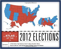
UW Geography Professor and WGA Steering Commitee member Dr. Gerald Webster has contributed to an "Atlas of the 2012 Elections."
October 8, 2014
Germaine Wagner takes Giant Traveling Map of Africa to the Boys and Girls Club of Central Wyoming!
October 5, 2013
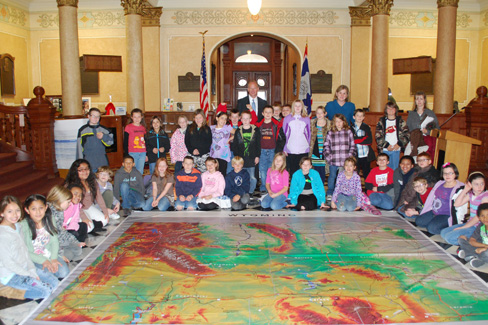
Recently, Governor Matt Mead signed a proclamation in honor of Wyoming's Geography Day at the State Capitol. Geography students from St. Mary's and Alta Vista were in attendance. The Governors Office has been gracious enough to share a few of their photos with us. Thanks Governor Mead, and lets make sure that geography remains an important subject in our statewide curriculum!
If you would like to join the Alliance, or are already a member but have not updated your information, please email us at wga@uwyo.edu with your name, your preferred email address, what school you work at, what grade and subject you teach, your school's address (including City, State, and Zip), and your preferred telephone number you can be reached at, and we will add you to our membership list! You will receive information about any sales on educational and instructional materials we find, websites of interest, and available alliance programs.
The University of Wyoming has earned its Research Level 1 (R1) status from the Carnegie Classification of Institutions of Higher Education, placing Wyoming's only four-year university with the top research universities in the United States.