
- Happy Jack and Vedauwoo Bike and Multi-Use Trail Map: Our "backyard" trails, just 15 minutes from town. Courtesy of the Pedal House, this map includes on-and-off system trails.
- Happy Jack XC Ski Trails: An amazing network of trails that are groomed by the amazing folks at the Medicine Bow Nordic Ski Association.
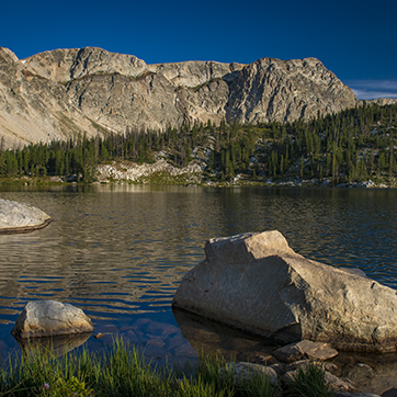
- Chimney Park Ski Trails: Another beautiful set of groomed trail loops, just 40 minutes away in the southern section of the Snowies.
- Curt Gowdy Trail Map: Curt Gowdy is a 27 minute drive and has excellent hiking, biking and equestrian trails.
- Glendo State Park Map: Glendo State Park has been adding a significant number of trails in the past few years. The trails are excellent.
- Campus Bicycle Route Map: A map of the approved bicycle routes on campus.
- Laramie Bike Map: Bike map and information on biking in Laramie
- Colorado Avalanche & Information Center
- Westwide Avalanche Network: Links to all North American avalanche centers.
- Powderbuzz.com: Colorado backcountry skiing, online resources, and information exchange.
- Eastern Wyoming - Avalanche Information Exchange
- Jackson Hole Mountain Resort: Jackson is about a six hour drive from Laramie.
- Snowy Range Ski Area: Located 30 minutes west of Laramie.
- Steamboat: Steamboat is about 2.5 hours from Laramie.
- Laramie Range Epic: A 31 mile or full 62 mile race, your choice! The race course winds through some amazing terrain in the Pole Mountain Trail System.
- Laramie Bike Net: Local bike group whose website includes events, trail maps, current conditions, and more!
- Laramie Mountain Bike Series: Offers a series of Mountain Bike races at Happy Jack and Curt Gowdy.
- MTB Project: MTB project has descriptions, photos, elevation profiles, distances, and ratings for trails all over the US. They also have a mobile app so you can download the trails to your phone, and take the map data with you.
- Pilot Hill Recreation Area: Local in-town trail that can connect you all the way to Happy Jack and Vedauwoo.
- Mountain Project: 185,663 routes around the world!
- International Climbers Festival: A world renowned climbing festival held every July in Lander, WY.
- Rogers Canyon Climbing Guide: Rogers Canyon is located a few minutes north of Laramie.
- Vedauwoo Bouldering Digital Guidebook
- Southeast Wyoming Climbers Coalition: Local area advocacy group
- Silent Trails Memorial Race: A 10 mile trail race at Happy Jack in honor of the 8 UW student athletes who were tragically lost in 2001.
- High Plains Harriers: Laramie running club that hosts group runs, events, and various races.
- Trail Run Project: Website and mobile app to help you find trails to run on.
- American Whitewater: Provides information about river locations, difficulty, flow rates, general descriptions and additional information.
- US Geological Survey Water Data: Real time USGS stream flow data.
- Mountainbuzz.com: A complete paddlers forum for Colorado.
- Grand Teton National Park: A six hour drive from Laramie.
- Curt Gowdy State Park: 20 minutes from Laramie, between Laramie and Cheyenne. Great mountain biking trails, camping, and two reservoirs.
- Devil's Tower National Monument: About a six hour drive from Laramie.
- Rocky Mountain National Park: Just a three hour drive to our south.
- Medicine Bow-Routt National Forest, Laramie Ranger District: The local land management agency for Vedauwoo, Happy Jack and Snowy Range areas.
- Yellowstone National Park: About an 8 hour drive from Laramie.
- Association of Outdoor Recreation and Education (AORE)
- Leave No Trace Center for Outdoor Ethics
- Student Organizations: There are many registered student organizations at UW that focus on outdoor recreation.
The University of Wyoming has earned its Research Level 1 (R1) status from the Carnegie Classification of Institutions of Higher Education, placing Wyoming's only four-year university with the top research universities in the United States.