Grasshoppers of Wyoming and the West
Entomology
Ecological Factor Maps
Vegetation
from Chapter III of Spatial Analysis of Ecological Factors Related to Grasshopper Population Dynamics in Wyoming
Vegetation Map | Precipitation Map | Elevation Map | Evapotranspiration Map | Soil Map

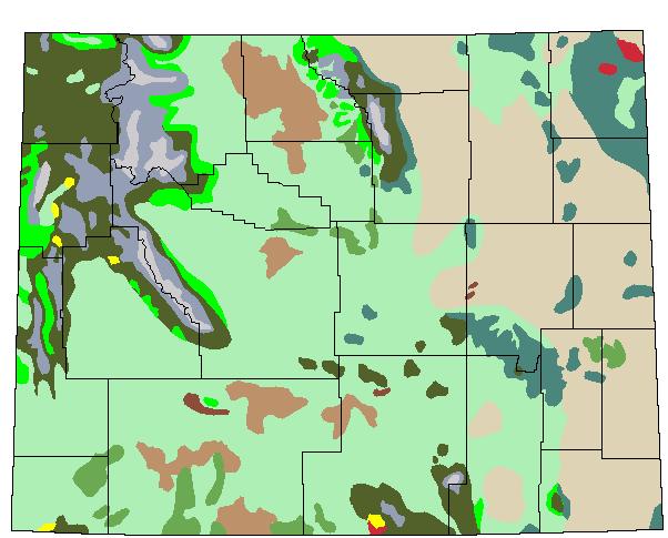
Fig. 2. Vegetation map showing 12 major vegetation types found in Wyoming, adapted from Roberts (1989). Not shown are vegetation types associated with riparian zones or cultivated areas. Green shading = sagebrush steppe; tan shading = mixed-grass prairie; olive drab = lodgepole pine forest; dark green = ponderosa pine forest; light-blue = spruce-fir forest; peach = desert shrublands; mint green = douglas fir forest; green = juniper woodland; crimson = oak woodland; brown = sand dunes; yellow = aspen forest; gray = alpine tundra; black = state and county borders.

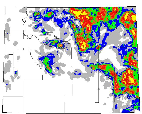
Fig. 1 (Updated from the 1960-93 map) Spatial distribution of rangeland grasshopper outbreaks in Wyoming from 1944 to 1994, with no data for 1982, 1983 or 1984 (Schell 1994). White = no recorded infestations; light shading = 1-2 yr infested; dark shading = 3-4 yr infested; purple = 5 yr infested; blue-green = 6-7 yr infested; red = 8-9 yr infested; orange =10-11 yr infested; yellow = 12-21 yr infested; black = state and county borders.
Back to Wyoming Grasshopper Maps
