A map, power lines, and a close up of a map on a phone screen.

Data, Applications, and Products

WyGISC is involved in developing a variety of web-based geospatial applications. The center also creates and maintains various products including geospatial data on behalf of its clients and partners.


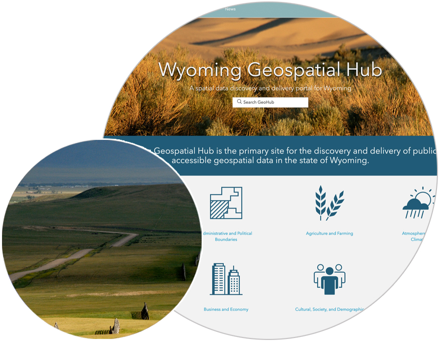
Wyoming Geospatial Data Hub

The Wyoming Geospatial Hub (GeoHub) is the primary site for discovering and delivering publicly accessible geospatial data about Wyoming.


WYOMING GEOSPATIAL DATA HUB
Wyoming Geospatial Hub home page with a landscape photo over it.
Two deer

Wyoming Migration Corridor Disturbance Viewer

This tool highlights current levels of human disturbance in Wyoming’s designated mule deer migration corridors.

Lake and snowy mountains

Wyoming Water & Climate Hub

Connecting people with water and climate data for Wyoming.

Granite cliffs in autumn

Pole Mountain Gateways

A project designed to gather public input on the Pole Mountain Unit in advance of broad-scale Forest Service planning.

Migration logo

Wyoming Migration Initiative

Ungulate migration database and viewer.

An picture of a sage-grouse.

OneSteppe

Greater sage-grouse core area and online DDCT website. 

A riverbank

SuiteWater

Natural resources planning and analysis tool.

An oil well at sunset.

Natural Resource & Energy Explorer (NREX)

Supports pre-planning development considerations by enabling discovery, analysis, and assessment.

Pronghorn deer running

State Wildlife Action Plan (SWAP)

Species of concern & habitat analysis interactive tool.

Sky at sunset

Wyoming Water and Climate Atlas

Climate, weather, snowpack, stream flow, and state water development information.

Oil well with a hazy landscape in the background.

Wyoming Reservoir Information Tool (WyRIT)

Interactive and queryable map of oil and gas reservoirs, pipelines, and seismic exchange.

Wyoming landscape

Wyoming Public Lands Initiative Information Hub

The Hub provides information and mapping resources for a multi-county legislative lands package broadly supported by public lands stakeholders in Wyoming.

A blue circle with Wyoming written in the center.

Wyoming State Broadband Program

Measuring connectivity at any location throughout the state.

Various kinds of pills

Wyoming Opioid Epidemic Information Portal

Access to maps of community resources and overdose deaths in Wyoming.

Grassland landscape

Strategic Habitat Plan (SHP)

The SHP application provides the Wyoming Game and Fish Department with tools to plan, implement, record, and track land management strategies through time to maintain habitat values and address critical issues.

Pine tree forest

Wyoming Wildfire Risk Assessment Portal

Access the Wyoming Wildfire Risk Assessment Portal (WYWRAP).

Teton mountains

Wyoming Student Atlas Project

Story maps which can be used in lesson plans as self-guided or instructor-guided activities.

Landscape picture of a lake and mountains at sunset.

WPLI Resource Mapping Tool

For use by Wyoming county advisory teams in evaluating and proposing public landuse recommendations as part of the Wyoming Public Lands Initiative (WPLI).


UW Operations Enterprise GIS

The University of Wyoming's GeoData Application Portal intended for internal planning and purposes.


Study Area Resource Request Application (SARRA)

Study Area Resource Request Application to support research cropfield planning.


Wyoming Wildlife and Natural Resources Trust (WWNRT)

The Wyoming Wildlife and Natural Resource Trust Projects Viewer & Editor supports the WWNRT for project reporting and tracking.


Wyoming Archeology Research and Community Hub (WyoARCH)

Internal records tool to support archaeological records and reporting.


Grazinglands Utilization System (GUS)

The Grazing Utilization System (GUS) is a GIS application designed and developed by Wyoming NRCS and the Wyoming Geographic Information Science Center (WYGISC) to assist NRCS conservation planning efforts in Wyoming. GUS is designed to help planners determine livestock distribution and effective utilization of pastures concerning slope and distance from the available water source(s).


Wyoming Integrated Resource Management Analyst (IRMA-WY)

The IRMA tool is a web-based resource analysis application that allows Wyoming NRCS employees to quickly and easily assess cultural and wildlife resources.

Three Species Viewer & Editor (3S)

The 3S Tools is a data integration tool to support Roundtail chub (Gila robusta), bluehead sucker (Catostomus discobolus), and flannelmouth sucker (Catostomus latipinnis) fish species.


Inland Cutthroat Trout (ICP) Viewer & Editor

This Conservation Agreement (Agreement) has been developed to expedite implementation of conservation measures for roundtail chub (Gila robusta), bluehead sucker (Catostomus discobolus), and flannelmouth sucker (Catostomus latipinnis), referred to as the three species, throughout their respective ranges as a collaborative and cooperative effort among resource agencies.


Office of the Tribal Water Engineer, Eastern Shoshone & Northern Arapaho

The Office of the Tribal Water Engineer is committed to conserving, managing, and protecting reservation water resources for future uses by generations to come.


Wyoming Interagency Spatial Database & Online Management (WISDOM) System

WISDOM is a web-based resource analysis application that allows Wyoming Game and Fish employees to assess proposed developments in Wyoming regarding the impact on wildlife and habitat.


WyGISC

University of Wyoming
Dept. 4008
1000 E. University Ave.
Laramie, WY 82071

Phone: (307) 766-2532
Email: wygisc@uwyo.edu

Follow Us

Facebook icon Instagram icon LinkedIn icon YouTube icon


Subscribe to Our Email List