
Ground Penetrating Radar (GPR)
GPR Overview:
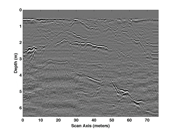
Ground penetrating radar (GPR) is a widely used technique in near-surface geophysics. It is very similar to reflection seismology, in that the product is generally an image of detailed structures in the subsurface (e.g., the orientation of interfaces in a sedimentary sequence). GPR sends out a pulse of electromagnetic energy, traveling as a wave and centered around the dominant antenna frequency (typically 50 MHz – 1 GHz). The instrument has both a transmitting (Tx) and receiving (Rx) antenna. When the outgoing electromagnetic pulse encounters a contrast in dielectric permittivity, some of the energy bounces back to the receiving antenna, where it is recorded. The travel times of the reflected energy (typically recorded in ns, nanoseconds – remember this energy is traveling at a significant fraction of the speed of light) provide information about the depths of interfaces in the subsurface. The GPR method is typically suited for shallow surveys that need a high resolution, so it is it is prominent in environmental and engineering applications.
Limitations:
Radar does not work well in highly electrically conductive regions, since conductive materials attenuate electromagnetic waves quickly. Time-to-depth conversions require accurate estimates of the EM wave velocity in the subsurface, which can be obtained either by fitting hyperbolas in the recorded data or by acquiring multi-offset data.
The GPR method has also been used in the following geological applications; sedimentary/soil structure, tree roots study, contaminant mapping, water table mapping, water content of soils, glaciology, concrete integrity and archaeology.
The University of Wyoming has earned its Research Level 1 (R1) status from the Carnegie Classification of Institutions of Higher Education, placing Wyoming's only four-year university with the top research universities in the United States.