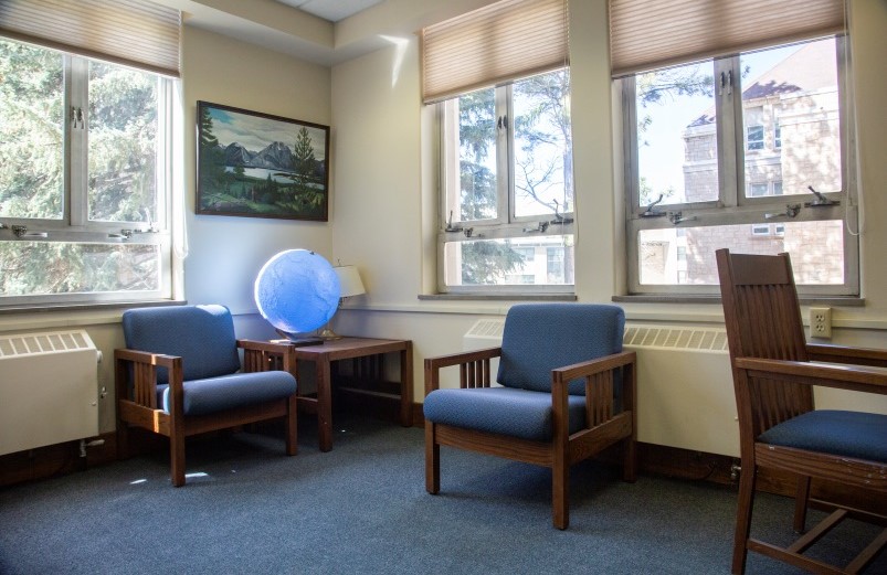
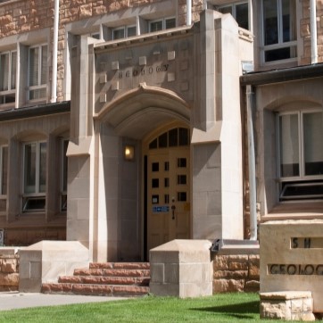
The Brinkerhoff Geology Library supports students, faculty, and researchers with a focused collection of geological literature, maps, and data resources. It provides a quiet study environment and access to library staff who can assist with research needs. The Geology Library is both beautiful and functional, with an open feel upstairs and cozy study spaces throughout. Collections are housed on electronically-controlled compact shelving. The Geology Library is located in the Geology Building at the Northwest corner of the UW Campus.
About the Geology Library
The Geology Library collects books, journals, maps, and government publications on geology, geophysics, physical geography, mining and petroleum geology, and geological engineering. The Geology Library collects Wyoming aerial photographs from a number of government agencies and private firms. The collection focuses on Wyoming and the Rocky Mountain region.
- Although most recently issued journals are available online only, we have extensive print holdings of older volumes. Search the library collections by journal name to find both.
- Print copies of USGS maps & documents, State geological survey, and association publications are collected; although many current publications are only available online.
- UW Geology Theses and Dissertations are available in print and online. Theses and Dissertations are stored at the Library Annex. The Library Annex is closed to the public. Please request materials using Hold4Me or Interlibrary Loan, or set up an appointment, contact libcirc@uwyo.edu.
- Please ask for assistance in locating maps as they may be in several locations and may not be in the online catalogs.
- Requests, recommendations, and donations are welcomed.
The Geology Library has two reservable study rooms and a small number of student computers.
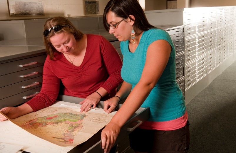
Geology Library Map Holdings
The library's print map collections are located in either the Brinkerhoff Geology Library or the Hebard Map Collection (part of the Emmett D. Chisum Special Collections located on the 3rd floor of Coe Library).
The Geology Library holds aerial & infrared photographs, USGS Topographic maps, US Forest Service maps, BLM maps, and more.
The Hebard Collection is historic in scope and holds Sanborn Fire Insurance Maps, USGS Topographic maps, highway maps, and many historic maps of the American West and Wyoming. These items to not circulate and must be used in the Chisum Reading Room in Coe Library.
BLM Surface Management/Mineral Management Maps
BLM maps show surface and sub-surface mineral rights ownership status (private land owners are not indicated). BLM maps are currently published at a scale of 1:100,000, covering a 35 x 50 mile area.
See the index map for Wyoming to determine the appropriate sheet.
Topographic maps
The Geology Library houses a collection of USGS topographic maps at scales of 1:24,000, 1:100,000, and 1:250,000. All editions for Wyoming and only the most current editions for other states are retained. Maps are filed by state and then alphabetically by sheet name in the Map Room. Search GNIS by placename.
Political & Thematic Maps
Maps showing political and administrative areas, energy, soils, climate, and transportation are located in the Map Room and on the Map Shelves. Most are organized by U.S. state, country, and regions using Library of Congress call numbers. Use the call number guides in these areas to identify the appropriate call numbers for the location you are interested in. CIA country political maps are in the Map Room Government Document drawers; these are filed alphabetically by country under the PREX heading.
Geologic Maps
Geological Maps are published by the Federal Government (USGS), state geological surveys, and professional societies. The Library focuses collection efforts on Wyoming and the Rocky Mountain region. The USGS publishes geological maps of all states and many countries. Sources for identifying published geological maps are GeoRef and the National Geologic Map Database. Search the library collections to determine if the Library owns a print copy and to find the location and call no. Many state geological surveys have maps available for download on their websites at no charge.
Historical Maps
Sanborn Fire Insurance Maps
The UW Libraries have three versions of these important historical maps for Wyoming. The original, color maps are cataloged and housed in Special Collections. A black & white, scanned collection is (accessible only if signed on to WyoWeb). These include some years that are not available in paper. A third black & white set is available on microfilm at Coe Library and also provides some coverage not available in paper.
Wyoming General Land Office (GLO) Maps and Mining Claim Maps
These are on microfiche in the Audiovisual Department of Coe Library. They are organized by township and range and cataloged using the call numbers G 4261 .G465 svar and G 4261 .H1 svar. GLO maps are also available online through the Wyoming Bureau of Land Management.
Army Map Service (AMS) Map Series
The U.S. Army Mapping Service (AMS) sets were produced during World War II and cover
most of Europe, North Africa, and East and South Asia. These are some of the most
detailed maps available for parts of China, especially Manchuria, and for islands
of the southwestern Pacific. The scales vary from 1:250,000, 1:50,000, and 1:25,000.
Consult library staff for assistance with this collection.
History of the Brinkerhoff Geology Library
In 1923, the Department of Geology, then located in the Hall of Science, had its own departmental library that consisted of the private collections of S. H. Knight, Wyoming Geological Survey contributions, and items bought by the Geology Department. When the Hall of Science expanded in the 1950s to become the S. H. Knight Geology Building, the department successfully argued that the department should have a branch library for geology in the building.
In August 1999, the renovated Geology Library was reopened as the Brinkerhoff Earth Resources Information Center in honor of major donors Zachery Brinkerhoff, Jr. and his son, Thomas Brinkerhoff.
The Barlow and Haun Map Room contains topographic maps at a variety of scales for the U.S., and many other maps of the U.S. and the world, with an emphasis on Wyoming. Jim Barlow and John Haun were the first geology Ph.D. recipients in the Geology Department and contributors to the map room renovation.
Further Resources
- GeoRef Subject Categories
- Dissertations & Theses @ University of Wyoming
Searches all theses and dissertations. All are available full text. - ScienceDirect
Features articles from science journals and books. - Lyell Collection
The Geological Society of London's online collection comprising of the Society’s journal titles, Special Publications and key book series. - National Technical Information Service (NTiS.gov)
Largest central resource for government-funded scientific, technical, engineering, and business related information available today.
USGS Sites
- Ask-A-Geologist (USGS)
From the U.S.G.S.: provides email link to Ask-A- Geologist
- Mineral Resources Program: Selected On-Line Fact Sheets
- USGS Publication Warehouse
Web application managed by the USGS library; providing access to publications written by USGS authors.
- USGS: Science Topics-Wyoming
Provides links to articles and websites specific to Wyoming and Wyoming counties.
General Sites
- Oxford Dictionary of Earth Sciences
- Oxford Companion to the Earth
- Oxford Encyclopedia of Global Change
- Oxford Companion to Global Change
- The Encyclopedia of Earth
A free, fully searchable collection of articles written by scholars, professionals, educators, and experts who collaborate and review each others work.
- Geology.com
Provides information on a variety of topics; including a geology dictionary.
- GeologyLink
Includes virtual field trips, links to News stories concerning the latest discoveries earth sciences and glossary.
- Geologic Guidebooks of North America Database
QE 1-350 - General
QE 351-399 - Mineralogy
QE 420-499 - Petrology
QE 521-545 - Volcanoes & Earthquakes
QE 601-613 - Structural Geology
QE 640-699 - Stratigraphy
QE 701-760 - Paleontology
QE 761-899 - Paleozoology
QE 901-996 - Paleobotany
Call numbers beginning with QE are located in the Brinkerhoff Geology Library.
- Encyclopedia of Paleoclimatology and Ancient Environments by
ISBN: 9781402044113
Publication Date: 2009-01-30 - Geology of the Florida Keys by
Call Number: QE100.F56 S55 2018ISBN: 9780813056517Publication Date: 2018-01-16
- Radiogenic Isotope Geology by
Call Number: QE501.4.N9 D53 2018ISBN: 9781107099449Publication Date: 2018-02-08
- A Field Guide for Science Writers by
Call Number: T11.F52 2006ISBN: 0195174984Publication Date: 2005-09-08
- A Guide to Field Guides by
Call Number: QH102 .S365 1999
ISBN: 9781563087073
Publication Date: 1999-07-15
The University of Wyoming has earned its Research Level 1 (R1) status from the Carnegie
Classification of Institutions of Higher Education, placing Wyoming's only four-year
university among the top research universities in the United States.
The University of Wyoming Libraries has been a Federal Depository Library since 1907. The collection comprises approximately 1.5 million print and microfiche
items in Coe Library and Library Annex, as well as maps, aerial and infrared photographs,
and geological publications housed in the Brinkerhoff Geology Library. The Federal
Document Library Program is changing from physical to digital distribution of government
information; UW Libraries provides access to online publications available from the
Federal Depository Library Program through the library catalog.